
File:EF2 tornado damage southwest of Fredonia, Kansas April 26, 2024.jpg
Size of this preview: 800 × 513 pixels. Other resolutions: 320 × 205 pixels | 640 × 411 pixels | 1,024 × 657 pixels | 1,280 × 821 pixels | 1,797 × 1,153 pixels.
Original file (1,797 × 1,153 pixels, file size: 1.9 MB, MIME type: image/jpeg)
| This is a file from the Wikimedia Commons. Information from its description page there is shown below. Commons is a freely licensed media file repository. You can help. |
Summary
| Description |
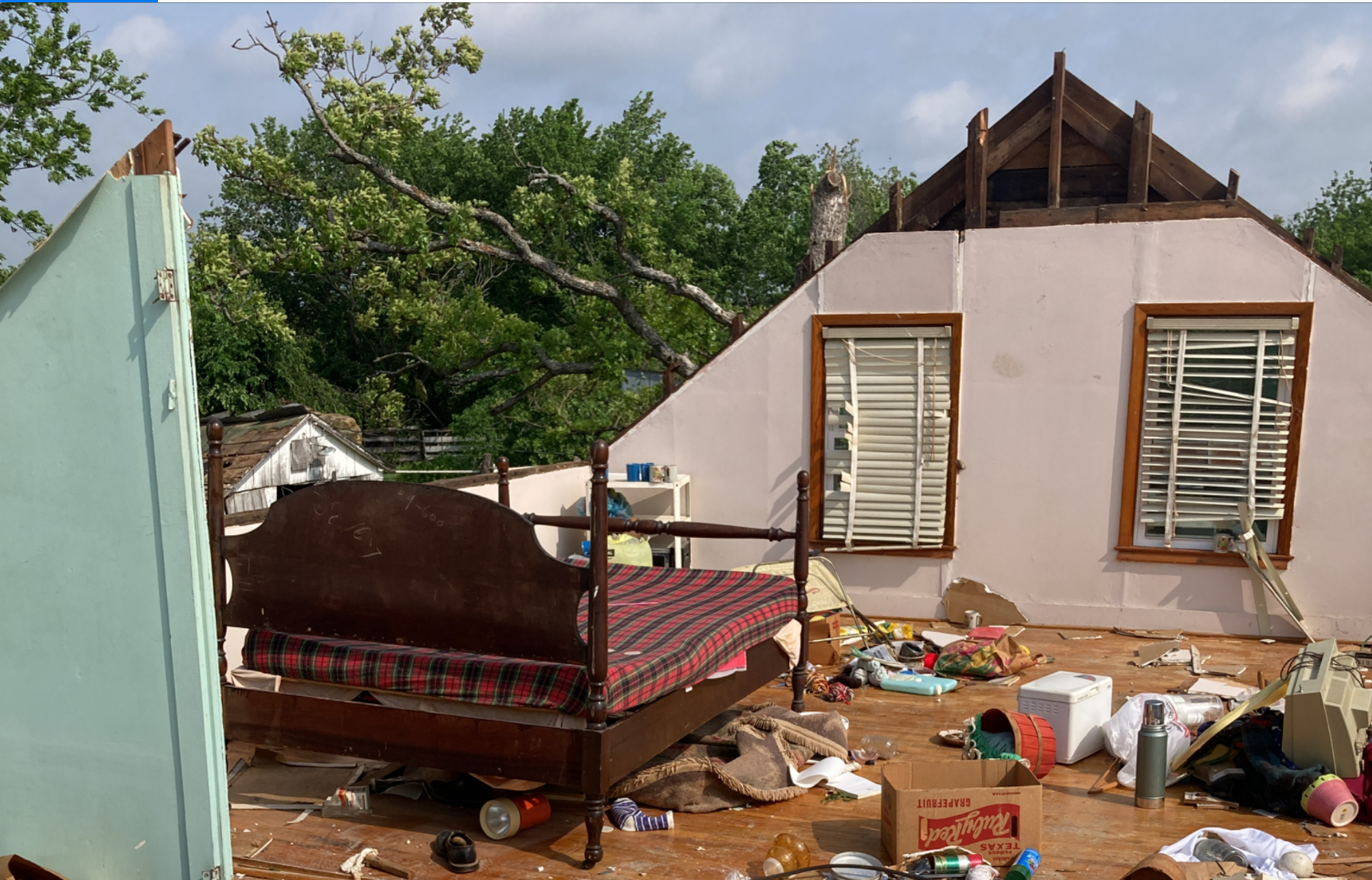
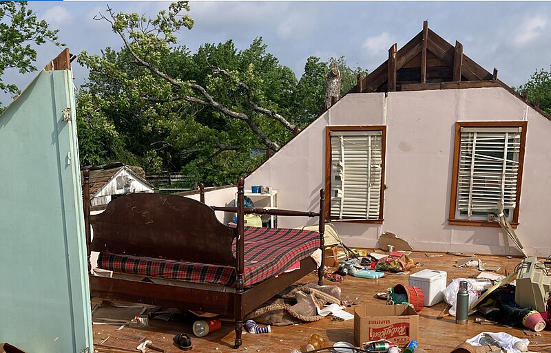
English: EF2 tornado damage pictured southwest of Fredonia, Kansas, the tornado of which was part of a tornado outbreak on April 26, 2024. |
| Date | |
| Source | https://services.dat.noaa.gov/arcgis/rest/services/nws_damageassessmenttoolkit/DamageViewer/FeatureServer/0/3977114/attachments/2391650 |
| Author | Unknown author |
Licensing
This image is in the public domain because it was stored on the web servers of the U.S. National Oceanic and Atmospheric Administration, specifically on the Damage Assessment Toolkit (DAT), an interactive map and database. Images on the Damage Assessment Toolkit are taken by the 122 National Weather Service forecast offices as well as the National Severe Storms Laboratory.
Thus, all images on the Damage Assessment Toolkit are public domain.
|
v
File history
Click on a date/time to view the file as it appeared at that time.
| Date/Time | Thumbnail | Dimensions | User | Comment | |
|---|---|---|---|---|---|
| current | 02:13, 28 April 2024 | | 1,797 × 1,153 (1.9 MB) | Tails Wx | Uploaded a work by {{Unknown|author}} from https://services.dat.noaa.gov/arcgis/rest/services/nws_damageassessmenttoolkit/DamageViewer/FeatureServer/0/3977114/attachments/2391650 with UploadWizard |
File usage
No pages on the English Wikipedia use this file (pages on other projects are not listed).