
File:Eritrea Anseba.png
No higher resolution available.
Eritrea_Anseba.png (462 × 409 pixels, file size: 6 KB, MIME type: image/png)
| This is a file from the Wikimedia Commons. Information from its description page there is shown below. Commons is a freely licensed media file repository. You can help. |
Summary
Transwiki approved by: w:en:User:Dmcdevit
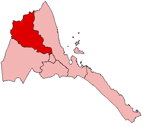
| Description |
English: Map of Eritrea showing the Anseba Region; created with the GIMP. Made by w:en:User:Acntx |
| Date | 11 July 2005 (original upload date) |
| Source | Originally from en.wikipedia; description page is/was here. |
| Author | Original uploader was Acntx at en.wikipedia |
| Permission (Reusing this file) |
GFDL-WITH-DISCLAIMERS; Released under the w:en:GNU Free Documentation License. |
Licensing
| This file is licensed under the Creative Commons Attribution-Share Alike 3.0 Unported license. Subject to disclaimers. | ||
| ||
| This licensing tag was added to this file as part of the GFDL licensing update. |

|
Permission is granted to copy, distribute and/or modify this document under the terms of the GNU Free Documentation License, Version 1.2 or any later version published by the Free Software Foundation; with no Invariant Sections, no Front-Cover Texts, and no Back-Cover Texts. A copy of the license is included in the section entitled GNU Free Documentation License. Subject to disclaimers. |
Original upload log
| date/time | username | resolution | size | edit summary |
|---|---|---|---|---|
| 07:07, 11 July 2005 | w:en:User:Acntx | 462×409 | 6 KB |
Image description page history
| link | date/time | username | edit summary |
|---|---|---|---|
| [1] | 19:48, 8 November 2007 | w:en:User:Dmcdevit | |
| [2] | 20:12, 7 May 2007 | w:en:User:Cydebot | |
| [3] | 07:09, 11 July 2005 | w:en:User:Acntx | |
| [4] | 07:07, 11 July 2005 | w:en:User:Acntx |
![[1]](https://en.wikipedia.org/w/index.php?title=Image:Eritrea_Anseba.png&redirect=no&oldid=129035807)
![[3]](https://en.wikipedia.org/w/index.php?title=Image:Eritrea_Anseba.png&redirect=no&oldid=18584024)
![[4]](https://en.wikipedia.org/w/index.php?title=Image:Eritrea_Anseba.png&redirect=no&oldid=18583950)
File history
Click on a date/time to view the file as it appeared at that time.
| Date/Time | Thumbnail | Dimensions | User | Comment | |
|---|---|---|---|---|---|
| current | 03:04, 10 November 2007 | | 462 × 409 (6 KB) | BetacommandBot | Transwiki approved by: w:en:User:Dmcdevit {{Information |Description={{en|Map of Eritrea showing the Anseba Region; created with the GIMP. Made by [[w:en::en:User:Acntx]] [[w:en::en:commons:Category:Maps of Eritrea]] [[w:en::en:commons:Category: |
File usage
No pages on the English Wikipedia use this file (pages on other projects are not listed).
Global file usage
The following other wikis use this file:
- Usage on bg.wikipedia.org
- Usage on br.wikipedia.org
- Usage on da.wikipedia.org
- Usage on ja.wikipedia.org
- Usage on ko.wikipedia.org
- Usage on no.wikipedia.org
- Usage on ro.wikipedia.org
- Usage on sco.wikipedia.org
- Usage on sw.wikipedia.org