
File:Estado Nor-Peruano.svg

Size of this PNG preview of this SVG file: 576 × 600 pixels. Other resolutions: 230 × 240 pixels | 461 × 480 pixels | 738 × 768 pixels | 983 × 1,024 pixels | 1,967 × 2,048 pixels | 850 × 885 pixels.
Original file (SVG file, nominally 850 × 885 pixels, file size: 632 KB)
| This is a file from the Wikimedia Commons. Information from its description page there is shown below. Commons is a freely licensed media file repository. You can help. |
Summary
| Description |
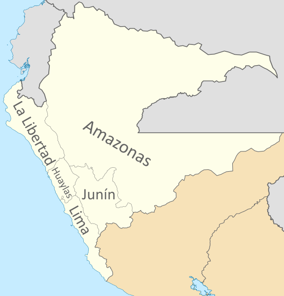
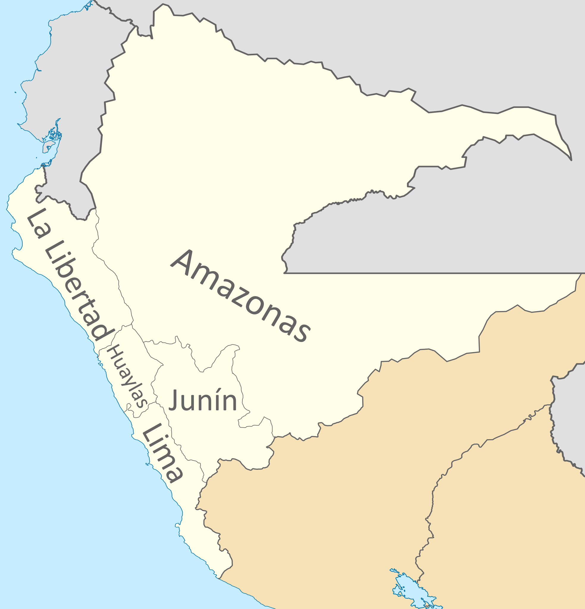
Español: Mapa del Estado Nor-Peruano, Confederación Perú-Boliviana.
Incluye el territorio amazonico disputado con Ecuador, Colombia y Brasil.
English: Map of the North-Peruvian State, Peru-Bolivian Confederation.
It includes the Amazon disputed territory with Ecuador, Colombia and Brazil. |
| Date | |
| Source |
Own work Coastline extracted from: File:Ecuador location map.svg & File:Chile location map.svg by NordNordWest & File:Peru location map.svg by Spischot |
| Author |
Janitoalevic Coastline extracted from: File:Ecuador location map.svg & File:Chile location map.svg by NordNordWest & File:Peru location map.svg by Spischot |
| Other versions | File:Divisiones administrativas de la Confederación Perú-Boliviana.svg |
Licensing

|
Permission is granted to copy, distribute and/or modify this document under the terms of the GNU Free Documentation License, Version 1.2 or any later version published by the Free Software Foundation; with no Invariant Sections, no Front-Cover Texts, and no Back-Cover Texts. A copy of the license is included in the section entitled GNU Free Documentation License. |
This file is licensed under the Creative Commons Attribution-Share Alike 3.0 Unported license.
- You are free:
- to share – to copy, distribute and transmit the work
- to remix – to adapt the work
- Under the following conditions:
- attribution – You must give appropriate credit, provide a link to the license, and indicate if changes were made. You may do so in any reasonable manner, but not in any way that suggests the licensor endorses you or your use.
- share alike – If you remix, transform, or build upon the material, you must distribute your contributions under the same or compatible license as the original.
File history
Click on a date/time to view the file as it appeared at that time.
| Date/Time | Thumbnail | Dimensions | User | Comment | |
|---|---|---|---|---|---|
| current | 02:35, 22 July 2020 | | 850 × 885 (632 KB) | Janitoalevic | + Huaylas |
| 23:55, 27 August 2019 |  | 850 × 885 (655 KB) | Janitoalevic | User created page with UploadWizard |
File usage
The following 6 pages use this file:
- Department of Amazonas (Peru–Bolivian Confederation)
- Department of Huaylas (Peru–Bolivian Confederation)
- Department of Junín (Peru–Bolivian Confederation)
- Department of La Libertad (Peru–Bolivian Confederation)
- Department of Lima (Peru–Bolivian Confederation)
- Subdivisions of the Peru–Bolivian Confederation
Global file usage
The following other wikis use this file:
- Usage on ca.wikipedia.org
- Usage on de.wikipedia.org
- Usage on es.wikipedia.org
- Estado Nor-Peruano
- Organización territorial de la Confederación Perú-Boliviana
- Departamento de Amazonas (Confederación Perú-Boliviana)
- Departamento de Lima (Confederación Perú-Boliviana)
- Departamento de Junín (Confederación Perú-Boliviana)
- Departamento de La Libertad (Confederación Perú-Boliviana)
- Departamento de Huaylas (Confederación Perú-Boliviana)
- Usage on pl.wikipedia.org
- Usage on www.wikidata.org