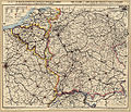
File:F. Müllhaupt's Militarische & Verkehrs-Karte der Deutsch-Französischen Grenze...jpg
Appearance

Size of this preview: 700 × 599 pixels. Other resolutions: 280 × 240 pixels | 561 × 480 pixels | 897 × 768 pixels | 1,196 × 1,024 pixels | 2,392 × 2,048 pixels | 8,150 × 6,978 pixels.
Original file (8,150 × 6,978 pixels, file size: 75.1 MB, MIME type: image/jpeg)
File history
Click on a date/time to view the file as it appeared at that time.
| Date/Time | Thumbnail | Dimensions | User | Comment | |
|---|---|---|---|---|---|
| current | 13:02, 4 April 2013 |  | 8,150 × 6,978 (75.1 MB) | ComputerHotline | {{LargeImage}} {{Information |Description= Titre : F. Müllhaupt's Militarische & Verkehrs-Karte der Deutsch-Französischen Grenze.... Carte militaire et commerciale des frontières franco-allemandes ainsi que des Etats limitrophes de la Belgique, de l... |
File usage
No pages on the English Wikipedia use this file (pages on other projects are not listed).
Global file usage
The following other wikis use this file:
- Usage on be-tarask.wikipedia.org
- Usage on bn.wikipedia.org
- Usage on crh.wikipedia.org
- Usage on cv.wikipedia.org
- Usage on hu.wikipedia.org
- Usage on ka.wikipedia.org
- Usage on ko.wikipedia.org
- Usage on krc.wikipedia.org
- Usage on lbe.wikipedia.org
- Usage on nl.wikipedia.org
- Usage on os.wikipedia.org
- Usage on pt.wikipedia.org
- Usage on ru.wikipedia.org
- Usage on ru.wikinews.org
- Usage on sah.wikipedia.org
- Usage on sq.wikipedia.org
- Usage on uk.wikipedia.org
- Usage on vi.wikipedia.org
- Usage on xal.wikipedia.org
- Usage on zh.wikipedia.org

