
File:Ffridd Gate station site geograph-3516553-by-Ben-Brooksbank.jpg
Size of this preview: 800 × 483 pixels. Other resolutions: 320 × 193 pixels | 640 × 386 pixels | 1,024 × 618 pixels | 1,280 × 772 pixels | 2,391 × 1,443 pixels.
Original file (2,391 × 1,443 pixels, file size: 2.66 MB, MIME type: image/jpeg)
| This is a file from the Wikimedia Commons. Information from its description page there is shown below. Commons is a freely licensed media file repository. You can help. |
Summary
| Description |
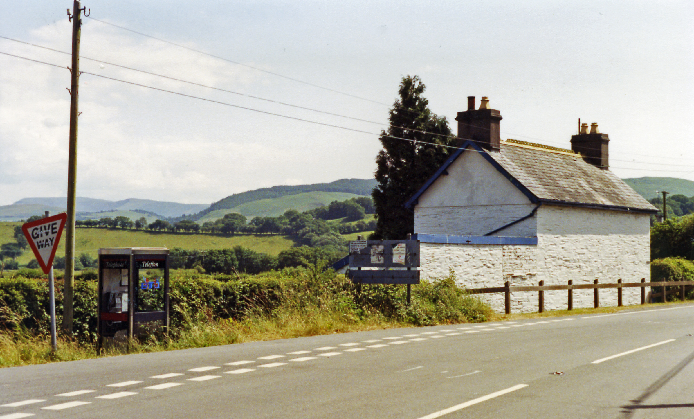
English: Site/remains of Ffridd Gate station, beside A487 near confluence of Afon Dulas with Dovey Valley. View southward, towards Machynlleth: this was the first station out of Machynlleth on the narrow-gauge line up the Afon Dulas valley to Corris and Aberllefeni, closed long ago - 1/1/31. Across the Dovey Valley nearby are the hills beside the Afon Llyfnant and in the distance is the Plynlimon Fawr massif rising to 2,469 ft. |
| Date | |
| Source | From geograph.org.uk |
| Author | Ben Brooksbank |
| Permission (Reusing this file) |
Creative Commons Attribution Share-alike license 2.0 |
| Attribution (required by the license) | Ben Brooksbank / Site/remains of Ffrith Gate station, beside A487 near confluence of Afon Dulas with Dovey Valley / |
| Camera location | | View this and other nearby images on: OpenStreetMap |
|---|
Licensing

|
This image was taken from the Geograph project collection. See this photograph's page on the Geograph website for the photographer's contact details. The copyright on this image is owned by Ben Brooksbank and is licensed for reuse under the Creative Commons Attribution-ShareAlike 2.0 license.
|
This file is licensed under the Creative Commons Attribution-Share Alike 2.0 Generic license.
Attribution: Ben Brooksbank
- You are free:
- to share – to copy, distribute and transmit the work
- to remix – to adapt the work
- Under the following conditions:
- attribution – You must give appropriate credit, provide a link to the license, and indicate if changes were made. You may do so in any reasonable manner, but not in any way that suggests the licensor endorses you or your use.
- share alike – If you remix, transform, or build upon the material, you must distribute your contributions under the same or compatible license as the original.
File history
Click on a date/time to view the file as it appeared at that time.
| Date/Time | Thumbnail | Dimensions | User | Comment | |
|---|---|---|---|---|---|
| current | 06:46, 27 July 2013 | | 2,391 × 1,443 (2.66 MB) | Chevin | == {{int:filedesc}} == {{Information |Description={{en|1='''Site/remains of Ffridd Gate station, beside A487 near confluence of Afon Dulas with Dovey Valley.'''<br/> View southward, towards Machynlleth: this was the first station out of Machynlleth on ... |
File usage
The following pages on the English Wikipedia use this file (pages on other projects are not listed):
Global file usage
The following other wikis use this file:
- Usage on www.wikidata.org