
File:Gana 31.03.2009 048.jpg
Size of this preview: 800 × 449 pixels. Other resolutions: 320 × 180 pixels | 640 × 359 pixels | 1,024 × 575 pixels | 1,280 × 718 pixels | 2,048 × 1,149 pixels.
Original file (2,048 × 1,149 pixels, file size: 287 KB, MIME type: image/jpeg)
| This is a file from the Wikimedia Commons. Information from its description page there is shown below. Commons is a freely licensed media file repository. You can help. |
| Description |
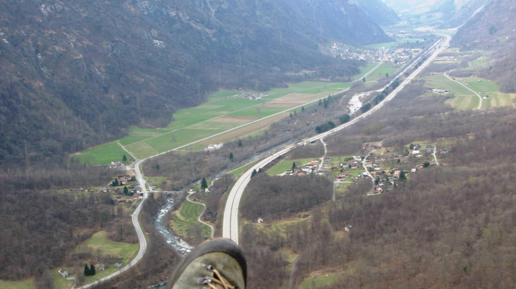
English: View from a paraglider over the plain between Sorte (in the foreground on the right of the motorway) and Lostallo (in the background on the left of the motorway) in the Swiss canton of Grisons. In the centre of the picture, between the highway and the main road 13, is the nationally important alluvial zone Rosera, through which the Moësa flows. In the background, the nationally important dry grassland/pasture Von (area of over 8 ha) is visible on the right of the motorway at the height of Lostallo. Deutsch: Blick vom Gleitschirm über die Ebene zwischen Sorte (im Vordergrund rechts der Autobahn) und Lostallo (im Hintergrund links der Autobahn) im Schweizer Kanton Graubünden. In der Bildmitte erstreckt sich zwischen der Autobahn und der Hauptstrasse 13 das national bedeutende Auengebiet Rosera, durchflossen von der Moësa. Im Hintergrund ist auf der Höhe von Lostallo rechts der Autobahn die national bedeutende Trockenwiese/-weide Von (über 8 ha) sichtbar. Français : Vue du parapente sur la plaine entre Sorte (au premier plan à droite de l'autoroute) et Lostallo (à l'arrière-plan à gauche de l'autoroute) dans le canton suisse des Grisons. Au centre de l'image, entre l'autoroute et la route principale 13, s'étend la zone alluviale d'importance nationale Rosera, traversée par la Moësa. En arrière-plan, à la hauteur de Lostallo, à droite de l'autoroute, on peut voir la prairie/le pâturage sec Von, d'importance nationale (surface de plus de 8 ha). Italiano: Vista da un parapendio sulla pianura tra Sorte (in primo piano a destra dell'autostrada) e Lostallo (sullo sfondo a sinistra dell'autostrada) nel Cantone svizzero dei Grigioni. Al centro dell'immagine, tra l'autostrada e la strada statale 13, si trova l'area golenale "Rosera", di importanza nazionale, attraverso la quale scorre il Moësa. Sullo sfondo, il prato/pascolo secco di importanza nazionale "Von" (superficie di oltre 8 ettari) è visibile sulla destra dell'autostrada all'altezza di Lostallo. |
||||||
| Date | |||||||
| Source | originally posted to Flickr as Gana 31.03.2009 048 | ||||||
| Author | Claudio Vosti | ||||||
| Permission (Reusing this file) |
This file is licensed under the Creative Commons Attribution-Share Alike 2.0 Generic license.
|
||||||
| Protected |
|
| Annotations | This image is annotated: View the annotations at Commons |
File history
Click on a date/time to view the file as it appeared at that time.
| Date/Time | Thumbnail | Dimensions | User | Comment | |
|---|---|---|---|---|---|
| current | 23:53, 22 October 2009 | | 2,048 × 1,149 (287 KB) | Flickr upload bot | Uploaded from http://flickr.com/photo/85864219@N00/3402469410 using Flickr upload bot |
File usage
The following pages on the English Wikipedia use this file (pages on other projects are not listed):
Global file usage
The following other wikis use this file:
- Usage on de.wikipedia.org
- Usage on fr.wikipedia.org
- Usage on id.wikipedia.org
- Usage on lmo.wikipedia.org
- Usage on nn.wikipedia.org
- Usage on www.wikidata.org
- Usage on zh.wikipedia.org