
File:Hoffner HD Sanborn map.png
No higher resolution available.
Hoffner_HD_Sanborn_map.png (393 × 379 pixels, file size: 33 KB, MIME type: image/png)
| This is a file from the Wikimedia Commons. Information from its description page there is shown below. Commons is a freely licensed media file repository. You can help. |
| Object location | | View this and other nearby images on: OpenStreetMap |
|---|
| Description |
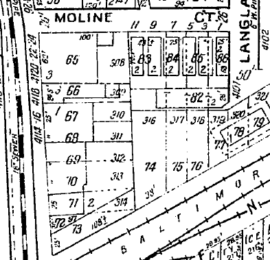
English: Sanborn map of the present-day Hoffner Historic District in the Northside neighborhood of Cincinnati, Ohio, United States. Located at approximately 39°9'40"N, 84°32'22"W, the historic district is listed on the National Register of Historic Places.
|
||
| Date | |||
| Source | Cropped from File:Sanborn map of Northside, Cincinnati.pdf | ||
| Author | Sanborn Maps | ||
| Permission (Reusing this file) |
|
File history
Click on a date/time to view the file as it appeared at that time.
| Date/Time | Thumbnail | Dimensions | User | Comment | |
|---|---|---|---|---|---|
| current | 06:28, 15 December 2013 | | 393 × 379 (33 KB) | Nyttend | {{Object location|39|9|40|N|84|32|22|W}} {{Information |Description={{en|{{w|Sanborn Maps|Sanborn map}} of the present-day {{w|Hoffner Historic District}} in the {{w|Northside, Cincinnati|Northside}} neighborhood of {{w|Cincinnati}}, {{w|Ohio}}, {{w|Un... |
File usage
No pages on the English Wikipedia use this file (pages on other projects are not listed).