
File:Hyde from Werneth Low.jpg
No higher resolution available.
Hyde_from_Werneth_Low.jpg (640 × 480 pixels, file size: 90 KB, MIME type: image/jpeg)
| This is a file from the Wikimedia Commons. Information from its description page there is shown below. Commons is a freely licensed media file repository. You can help. |
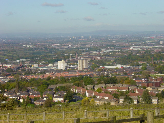
| Description | Hyde and Tameside from Werneth Low, in Greater Manchester, England. Hyde Town Hall is on the centre-left of this image. In the background is Dukinfield and Ashton-under-Lyne, both in Tameside. The Pennines are on the horizon. | ||
| Date | |||
| Source | geograph.org.uk | ||
| Author | Janine Cook | ||
| Permission (Reusing this file) |
This file is licensed under the Creative Commons Attribution-Share Alike 2.0 Generic license. Attribution: Janine Cook
|
||
| Attribution (required by the license) | Janine Cook / View from Werneth Low on a sunny day / | ||

| Object location | | View this and other nearby images on: OpenStreetMap |
|---|
_heading:337.00&language=en)
File history
Click on a date/time to view the file as it appeared at that time.
| Date/Time | Thumbnail | Dimensions | User | Comment | |
|---|---|---|---|---|---|
| current | 16:25, 11 November 2008 | | 640 × 480 (90 KB) | Jza84 | {{Information |Description=Hyde and Tameside from Werneth Low, in Greater Manchester, England. Hyde Town Hall is on the centre-left of this image. In the background is Dukinfield and Ashton-under-Lyne, both in Tameside. |Source=[http://www.geograph.org.u |
File usage
No pages on the English Wikipedia use this file (pages on other projects are not listed).
Global file usage
The following other wikis use this file:
- Usage on azb.wikipedia.org
- Usage on ceb.wikipedia.org
- Usage on cy.wikipedia.org
- Usage on es.wikipedia.org
- Usage on fa.wikipedia.org
- Usage on fr.wikipedia.org
- Usage on ga.wikipedia.org
- Usage on it.wikipedia.org
- Usage on lld.wikipedia.org
- Usage on nn.wikipedia.org
- Usage on pl.wikipedia.org
- Usage on ro.wikipedia.org
- Usage on sh.wikipedia.org
- Usage on uk.wikivoyage.org
- Usage on www.wikidata.org
- Usage on zh.wikipedia.org