
File:Imberhorne Viaduct - geograph.org.uk - 771698.jpg
No higher resolution available.
Imberhorne_Viaduct_-_geograph.org.uk_-_771698.jpg (640 × 479 pixels, file size: 130 KB, MIME type: image/jpeg)
| This is a file from the Wikimedia Commons. Information from its description page there is shown below. Commons is a freely licensed media file repository. You can help. |
Summary
| Description |
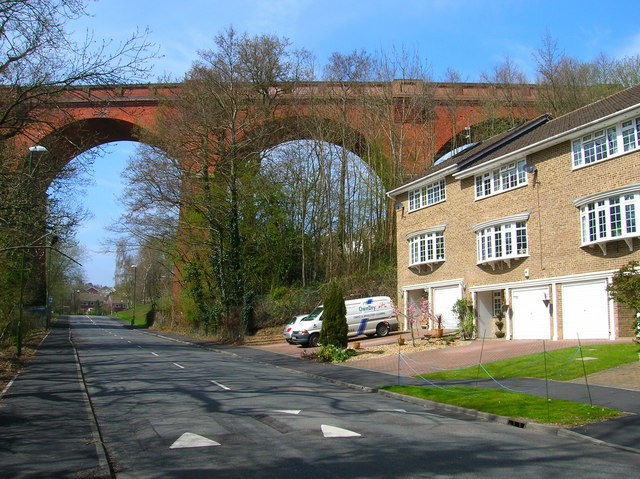
English: Imberhorne Viaduct Built in 1882 to carry the branch line from Lewes over a small Wealden valley and into East Grinstead. The line was closed in 1958 but the viaduct somehow survived being used by British rail as a turning point for their now terminus in East Grinstead. In recent years it has been purchased by the Bluebell Railway who are currently building an extension of their line from Kingscote to rejoin the main network nearby. In the near future steam trains will once again be seen travelling over the viaduct. This view is of three of the nine arches south of the viaduct. |
| Date | |
| Source | From geograph.org.uk |
| Author | Simon Carey |
| Attribution (required by the license) | Simon Carey / Imberhorne Viaduct / |
| Camera location | | View this and other nearby images on: OpenStreetMap |
|---|
_heading:292.00&language=en)
| Object location | | View this and other nearby images on: OpenStreetMap |
|---|
_heading:292.00&language=en)
Licensing

|
This image was taken from the Geograph project collection. See this photograph's page on the Geograph website for the photographer's contact details. The copyright on this image is owned by Simon Carey and is licensed for reuse under the Creative Commons Attribution-ShareAlike 2.0 license.
|
This file is licensed under the Creative Commons Attribution-Share Alike 2.0 Generic license.
Attribution: Simon Carey
- You are free:
- to share – to copy, distribute and transmit the work
- to remix – to adapt the work
- Under the following conditions:
- attribution – You must give appropriate credit, provide a link to the license, and indicate if changes were made. You may do so in any reasonable manner, but not in any way that suggests the licensor endorses you or your use.
- share alike – If you remix, transform, or build upon the material, you must distribute your contributions under the same or compatible license as the original.
File history
Click on a date/time to view the file as it appeared at that time.
| Date/Time | Thumbnail | Dimensions | User | Comment | |
|---|---|---|---|---|---|
| current | 22:06, 19 February 2011 | | 640 × 479 (130 KB) | GeographBot | == {{int:filedesc}} == {{Information |description={{en|1=Imberhorne Viaduct Built in 1882 to carry the branch line from Lewes over a small Wealden valley and into East Grinstead. The line was closed in 1958 but the viaduct somehow survived being used by B |
File usage
The following pages on the English Wikipedia use this file (pages on other projects are not listed):
Global file usage
The following other wikis use this file:
- Usage on azb.wikipedia.org
- Usage on de.wikipedia.org
- Usage on ru.wikipedia.org
- Usage on www.wikidata.org