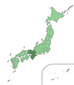
File:Japan Kinki Region large.png
Appearance

Size of this preview: 526 × 600 pixels. Other resolutions: 210 × 240 pixels | 421 × 480 pixels | 673 × 768 pixels | 898 × 1,024 pixels | 1,397 × 1,593 pixels.
Original file (1,397 × 1,593 pixels, file size: 76 KB, MIME type: image/png)
File history
Click on a date/time to view the file as it appeared at that time.
| Date/Time | Thumbnail | Dimensions | User | Comment | |
|---|---|---|---|---|---|
| current | 01:04, 16 February 2019 |  | 1,397 × 1,593 (76 KB) | TAKASUGI Shinji | copied from File:Japan Kinki Region large.png: the old version doesn’t have a boundary between Shimane and Yamaguchi. |
| 15:28, 22 October 2005 |  | 1,397 × 1,593 (78 KB) | Ningyou | Large size map of Japan with Kinki region highlighted, self made but originally based on a japanese mapbook. Category:Maps of Japan Category:Maps of Japanese prefectures |
File usage
The following 2 pages use this file:
Global file usage
The following other wikis use this file:
- Usage on de.wikipedia.org
- Usage on en.wiktionary.org
- Usage on fi.wikipedia.org
- Usage on hu.wikipedia.org
- Usage on ja.wikipedia.org
- Usage on ja.wiktionary.org
- Usage on mk.wikipedia.org
- Usage on pam.wikipedia.org
- Usage on su.wikipedia.org
- Usage on zh.wikipedia.org
