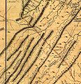
File:JeffFryDetail.jpg
Appearance

Size of this preview: 581 × 600 pixels. Other resolutions: 233 × 240 pixels | 465 × 480 pixels | 656 × 677 pixels.
Original file (656 × 677 pixels, file size: 102 KB, MIME type: image/jpeg)
File history
Click on a date/time to view the file as it appeared at that time.
| Date/Time | Thumbnail | Dimensions | User | Comment | |
|---|---|---|---|---|---|
| current | 20:05, 24 October 2009 |  | 656 × 677 (102 KB) | Valerius Tygart | {{Information |Description={{en|1=Detail from the “Fry-Jefferson map” of Virginia (1751) showing “Lord Fairfax his Boundry Line”.}} |Source= http://www.learnnc.org/lp/multimedia/7493 |Author=Peter Jefferson and Joshua Fry (1751) |Date=1751 |Permis |
File usage
The following page uses this file:
