
File:Karte Kyffhäuser.jpg
Size of this preview: 444 × 599 pixels. Other resolutions: 178 × 240 pixels | 356 × 480 pixels | 748 × 1,009 pixels.
Original file (748 × 1,009 pixels, file size: 571 KB, MIME type: image/jpeg)
| This is a file from the Wikimedia Commons. Information from its description page there is shown below. Commons is a freely licensed media file repository. You can help. |
Summary
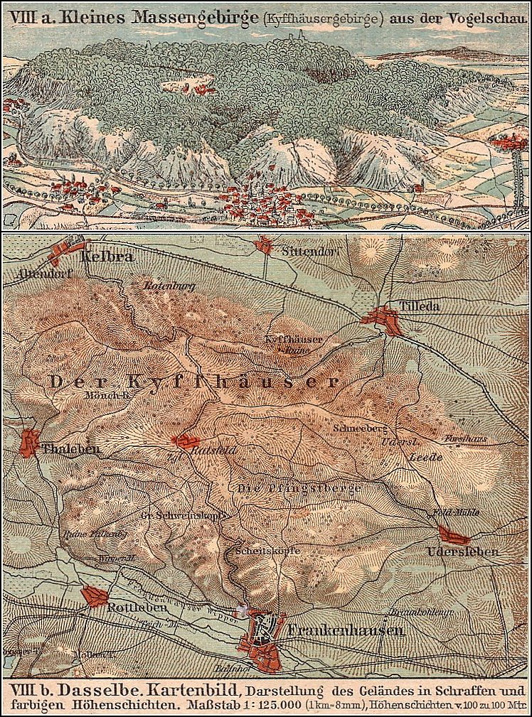
Deutsch: Alte Karte des Kyffhäuser.
Gescannt von de:benutzer:Mazbln, bearbeitet von Anton.
Aus Deutscher Schulatlas, Verlag von Theodor Hofmann Leipzig und Berlin, etwa 1913.
GNU-FDLLicensing
|
This work is in the public domain in its country of origin and other countries and areas where the copyright term is the author's life plus 70 years or fewer. | |
| This file has been identified as being free of known restrictions under copyright law, including all related and neighboring rights. | |
File history
Click on a date/time to view the file as it appeared at that time.
| Date/Time | Thumbnail | Dimensions | User | Comment | |
|---|---|---|---|---|---|
| current | 18:52, 21 June 2006 | | 748 × 1,009 (571 KB) | Anton~commonswiki | Alte Karte des Kyffhäuser Gescannt von de:benutzer:Mazbln, bearbeitet von Anton. Aus ''Deutscher Schulatlas'', Verlag von Theodor Hofmann Leipzig und Berlin, etwa 1913 GNU-FDL |
File usage
The following pages on the English Wikipedia use this file (pages on other projects are not listed):
Global file usage
The following other wikis use this file:
- Usage on de.wikipedia.org
- Usage on es.wikipedia.org
- Usage on hu.wikipedia.org
- Usage on ro.wikipedia.org