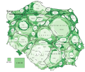
File:Kartogram ludnosci Polski.svg
Appearance

Size of this PNG preview of this SVG file: 774 × 600 pixels. Other resolutions: 310 × 240 pixels | 619 × 480 pixels | 991 × 768 pixels | 1,280 × 992 pixels | 2,560 × 1,984 pixels | 1,178 × 913 pixels.
Original file (SVG file, nominally 1,178 × 913 pixels, file size: 665 KB)
File history
Click on a date/time to view the file as it appeared at that time.
| Date/Time | Thumbnail | Dimensions | User | Comment | |
|---|---|---|---|---|---|
| current | 19:37, 13 February 2019 |  | 1,178 × 913 (665 KB) | PawełS | Legenda |
| 20:54, 22 March 2017 |  | 1,178 × 913 (665 KB) | PawełS | Piaseczyński do wyższej klasy, żeby zwiększyć odrębność klas | |
| 18:20, 14 March 2017 |  | 1,178 × 913 (664 KB) | PawełS | + gęstość zaludnienia + population density | |
| 21:48, 27 March 2013 |  | 1,074 × 906 (763 KB) | PawełS | {{Information |description={{pl|1=Liczba mieszkańców wg powiatów. Wielkość powiatów jest w przybliżeniu proporcjonalna do liczby mieszkańców. Im ciemniejszy kolor, tym większa jest rzeczywista powierzchnia powiatu.}}{{en|1=Poland – populati... |
File usage
The following page uses this file:
Global file usage
The following other wikis use this file:

