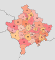
File:Kosovo municipalities.svg
Appearance

Size of this PNG preview of this SVG file: 269 × 296 pixels. Other resolutions: 218 × 240 pixels | 436 × 480 pixels | 698 × 768 pixels | 931 × 1,024 pixels | 1,861 × 2,048 pixels.
Original file (SVG file, nominally 269 × 296 pixels, file size: 426 KB)
File history
Click on a date/time to view the file as it appeared at that time.
| Date/Time | Thumbnail | Dimensions | User | Comment | |
|---|---|---|---|---|---|
| current | 16:46, 28 June 2017 |  | 269 × 296 (426 KB) | Hakuli | Border fixed |
| 13:17, 23 June 2011 |  | 337 × 371 (453 KB) | Пакко | upg according new administrative borders | |
| 14:35, 28 February 2008 |  | 267 × 292 (299 KB) | Future Perfect at Sunrise | fix numbering | |
| 20:43, 27 February 2008 |  | 267 × 292 (300 KB) | Jackaranga | removed labels for districts | |
| 20:33, 27 February 2008 |  | 630 × 490 (302 KB) | Jackaranga | colours + typo | |
| 15:22, 26 February 2008 |  | 630 × 490 (302 KB) | Jackaranga | hiding the labels in a manner mediawiki understands I hope | |
| 15:20, 26 February 2008 |  | 630 × 490 (302 KB) | Jackaranga | {{Information |Description= Numbered map of the municipalities of Kosovo, also showing the district devisions (+ hidden layer with district names that can be switched on in Inkscape if needed) |Source= Image:Kosovo admin.svg [[:Image:Kosovo municipal |
File usage
The following 2 pages use this file:

