
File:LA St Joseph 333337 1986 24000 geo page 1.jpg

Original file (2,021 × 2,466 pixels, file size: 1.74 MB, MIME type: image/jpeg)
| This is a file from the Wikimedia Commons. Information from its description page there is shown below. Commons is a freely licensed media file repository. You can help. |
Summary
| Description |
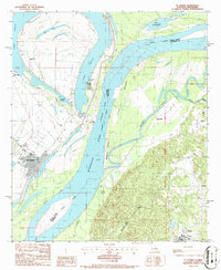
English: USGS 1:24000-scale Quadrangle for St. Joseph, LA 1986
Dates Publication Date 1986-01-01 Start Date 1983-01-01 End Date 1986-01-01 File Modification Date 2022-11-18 18:50:01 Citation U.S. Geological Survey, 1986, USGS 1:24000-scale Quadrangle for St. Joseph, LA 1986: U.S. Geological Survey. Summary USGS Historical Quadrangle in GeoPDF. Contacts Publisher : U.S. Geological Survey Originator : U.S. Geological Survey Point of Contact : U.S. Geological Survey Metadata Contact : U.S. Geological Survey Distributor : U.S. Geological Survey Attached Files Related External Resources Type: Online Link Information https://www.usgs.gov/programs/national-geospatial-program/historical-topographic-maps-preserving-past Type: Original Metadata Product Metadata https://thor-f5.er.usgs.gov/ngtoc/metadata/waf/maps/historicaltopo/pdf/LA/24000/LA_St_Joseph_333337_1986_24000_geo.xml Type: Browse Image Thumbnail JPG image of map https://prd-tnm.s3.amazonaws.com/StagedProducts/Maps/HistoricalTopo/PDF/LA/24000/LA_St%20Joseph_333337_1986_24000_tn.jpg Type: Download GeoPDF https://prd-tnm.s3.amazonaws.com/StagedProducts/Maps/HistoricalTopo/PDF/LA/24000/LA_St%20Joseph_333337_1986_24000_geo.pdf GeoTIFF https://prd-tnm.s3.amazonaws.com/StagedProducts/Maps/HistoricalTopo/GeoTIFF/LA/LA_St%20Joseph_333337_1986_24000_geo.tif Purpose The USGS Historical Quadrangle Scanning Project (HQSP) is scanning all scales and all editions of topographic maps published by the U.S. Geological Survey (USGS) since the inception of the topographic mapping program in 1884. This map is provided as a general purpose map in GeoPDF for users who are not GIS experts. Preview Image Thumbnail JPG image of map Thumbnail JPG image of map Map Map Preview Communities National Geospatial Program The National Map Tags Theme 7.5 x 7.5 minuteDownloadable DataGeoPDFGeoTIFFHistorical Topographic MapsHistorical Topographic Maps 7.5 x 7.5 Minute Map SeriesMapProvisionalimageryBaseMapsEarthCover Place LASt. Joseph Provenance Data source PRISM Additional Information Identifiers Type Scheme Key uuid inventory 38f187bd-0a02-f100-ab0c-9df4412f5af7 Item Actions |
| Date | |
| Source | https://www.sciencebase.gov/catalog/item/5a8a3e31e4b00f54eb3e9fe9 |
| Author | USGS |
Licensing
This work is in the public domain in the United States because it is a work prepared by an officer or employee of the United States Government as part of that person’s official duties under the terms of Title 17, Chapter 1, Section 105 of the US Code.
Note: This only applies to original works of the Federal Government and not to the work of any individual U.S. state, territory, commonwealth, county, municipality, or any other subdivision. This template also does not apply to postage stamp designs published by the United States Postal Service since 1978. (See § 313.6(C)(1) of Compendium of U.S. Copyright Office Practices). It also does not apply to certain US coins; see The US Mint Terms of Use.
|
 | |
| This file has been identified as being free of known restrictions under copyright law, including all related and neighboring rights. | ||
File history
Click on a date/time to view the file as it appeared at that time.
| Date/Time | Thumbnail | Dimensions | User | Comment | |
|---|---|---|---|---|---|
| current | 03:47, 2 August 2024 | | 2,021 × 2,466 (1.74 MB) | Jengod | Uploaded a work by USGS from https://www.sciencebase.gov/catalog/item/5a8a3e31e4b00f54eb3e9fe9 with UploadWizard |