
File:LithuanianHistory.svg

Size of this PNG preview of this SVG file: 522 × 599 pixels. Other resolutions: 209 × 240 pixels | 418 × 480 pixels | 669 × 768 pixels | 892 × 1,024 pixels | 1,785 × 2,048 pixels | 1,525 × 1,750 pixels.
Original file (SVG file, nominally 1,525 × 1,750 pixels, file size: 110 KB)
| This is a file from the Wikimedia Commons. Information from its description page there is shown below. Commons is a freely licensed media file repository. You can help. |
Summary
| Description |
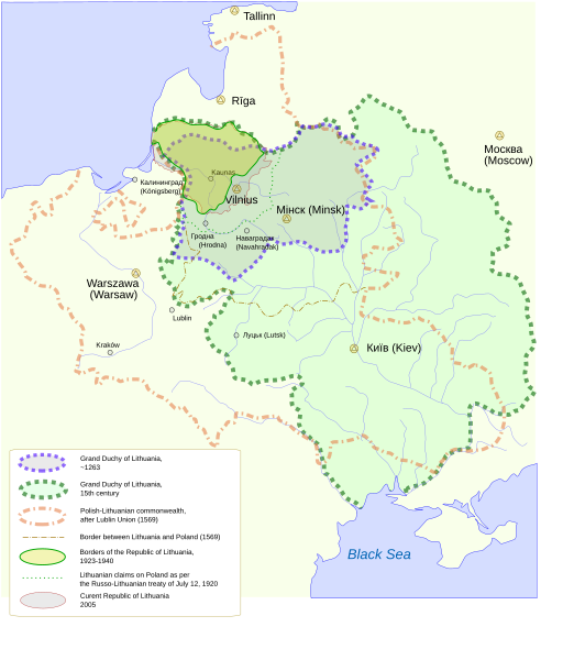
English: Historical Lithuanian borders Deutsch: Historische Grenzen Litauens |
| Date | |
| Source | Own work |
| Author | User:Knutux |
| Other versions |
[]
|
| SVG development |


Licensing
| This work has been released into the public domain by its author, Knutux. This applies worldwide. In some countries this may not be legally possible; if so: |
File history
Click on a date/time to view the file as it appeared at that time.
| Date/Time | Thumbnail | Dimensions | User | Comment | |
|---|---|---|---|---|---|
| current | 14:53, 23 December 2005 | | 1,525 × 1,750 (110 KB) | Urmas | |
| 06:32, 19 December 2005 |  | 1,525 × 1,750 (110 KB) | Knutux | small corrections (name Warsaw in parentheses, Lithuania claims in legend were in wrong color) | |
| 06:28, 19 December 2005 |  | 1,525 × 1,750 (110 KB) | Knutux | wrong page size | |
| 06:23, 19 December 2005 |  | 744 × 1,052 (110 KB) | Knutux | Historical Lithuanian borders Category:Historical maps of Lithuania |
File usage
No pages on the English Wikipedia use this file (pages on other projects are not listed).
Global file usage
The following other wikis use this file:
- Usage on frp.wikipedia.org
- Usage on fr.wikipedia.org
- Usage on tr.wikipedia.org
- Usage on uk.wikipedia.org