File:LocationRhodesia.png
Appearance
LocationRhodesia.png (250 × 115 pixels, file size: 5 KB, MIME type: image/png)
File history
Click on a date/time to view the file as it appeared at that time.
| Date/Time | Thumbnail | Dimensions | User | Comment | |
|---|---|---|---|---|---|
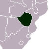
| current | 10:47, 31 December 2005 |  | 250 × 115 (5 KB) | *drew~commonswiki | *Description: Locator map for Rhodesia (now Zimbabwe). It shows Walvis Bay (Namibia) as part of South Africa (during the brief time Rhodesia existed, South Africa held Walvis Bay). *Source: [http://en.wikipedia.org/wiki/Image:LocationRhodesia.png] {{PD}} |
File usage
The following 5 pages use this file:
Global file usage
The following other wikis use this file:
- Usage on ca.wikipedia.org
- Usage on ckb.wikipedia.org
- Usage on da.wikipedia.org
- Usage on el.wikipedia.org
- Usage on el.wiktionary.org
- Usage on eo.wikipedia.org
- Usage on eo.wiktionary.org
- Usage on fa.wikipedia.org
- Usage on fy.wikipedia.org
- Usage on id.wikipedia.org
- Usage on mzn.wikipedia.org
- Usage on nl.wikipedia.org
- Usage on tg.wikipedia.org
- Usage on vi.wikipedia.org
- Usage on www.wikidata.org


