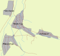
File:Location map of Temen-Suu, Kyrgyzstan.svg
Appearance

Size of this PNG preview of this SVG file: 643 × 600 pixels. Other resolutions: 257 × 240 pixels | 515 × 480 pixels | 823 × 768 pixels | 1,098 × 1,024 pixels | 2,196 × 2,048 pixels | 744 × 694 pixels.
Original file (SVG file, nominally 744 × 694 pixels, file size: 43 KB)
File history
Click on a date/time to view the file as it appeared at that time.
| Date/Time | Thumbnail | Dimensions | User | Comment | |
|---|---|---|---|---|---|
| current | 01:52, 11 November 2012 |  | 744 × 694 (43 KB) | Firespeaker | svg fix |
| 22:05, 10 November 2012 |  | 744 × 694 (45 KB) | Firespeaker | font fixes? | |
| 22:03, 10 November 2012 |  | 744 × 694 (45 KB) | Firespeaker | No frame | |
| 22:01, 10 November 2012 |  | 744 × 694 (45 KB) | Firespeaker | bigger labels, closer edges | |
| 06:22, 9 November 2012 |  | 744 × 744 (46 KB) | Firespeaker | {{Information |Description ={{en|1=Temen-Suu, Kyrgyzstan and surrounding villages}} {{ky|1=Кыргызстандагы Темен-Суу айылы жана айланасындагы башка айылдар}} |Source =own work from OSM s... |
File usage
The following page uses this file:
Global file usage
The following other wikis use this file:
- Usage on ceb.wikipedia.org
- Usage on fa.wikipedia.org
- Usage on uz.wikipedia.org
- Usage on www.wikidata.org

