
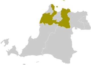
File:Locator Kabupaten Serang.png

Size of this preview: 800 × 577 pixels. Other resolutions: 320 × 231 pixels | 640 × 462 pixels | 801 × 578 pixels.
Original file (801 × 578 pixels, file size: 50 KB, MIME type: image/png)
| This is a file from the Wikimedia Commons. Information from its description page there is shown below. Commons is a freely licensed media file repository. You can help. |
Summary
| Description | |
| Date | 12 December 2011 (original upload date) |
| Source | Created from Tangerang Regency Wikimedia Commons file. |
| Author | Doseiai2 at English Wikipedia |
| Other versions | Derivative works of this file: Locator Kota Tangerang Selatan.png |
Licensing
Doseiai2 at English Wikipedia, the copyright holder of this work, hereby publishes it under the following license:
This file is licensed under the Creative Commons Attribution-Share Alike 3.0 Unported license.
Attribution: Doseiai2 at English Wikipedia
- You are free:
- to share – to copy, distribute and transmit the work
- to remix – to adapt the work
- Under the following conditions:
- attribution – You must give appropriate credit, provide a link to the license, and indicate if changes were made. You may do so in any reasonable manner, but not in any way that suggests the licensor endorses you or your use.
- share alike – If you remix, transform, or build upon the material, you must distribute your contributions under the same or compatible license as the original.
Original upload log
Transferred from en.wikipedia to Commons by Topographie using CommonsHelper.
The original description page was here. All following user names refer to en.wikipedia.
- 2011-12-12 11:07 Doseiai2 245×161× (4306 bytes) Whoops! too sleepy, wrong article! This time its correct!
- 2011-12-12 11:03 Doseiai2 245×161× (4223 bytes) Last version incorrect, shown city is Cilegon. Fixed.
- 2011-12-12 10:42 Doseiai2 245×161× (4176 bytes) Created from Tangerang Regency wikipedia commons file.
File history
Click on a date/time to view the file as it appeared at that time.
| Date/Time | Thumbnail | Dimensions | User | Comment | |
|---|---|---|---|---|---|
| current | 09:11, 20 March 2022 | | 801 × 578 (50 KB) | Afrogindahood | Graphical improvement |
| 21:30, 12 October 2012 |  | 245 × 161 (4 KB) | Topographie | Borders of municipalities and regencies have changed | |
| 00:48, 11 October 2012 |  | 245 × 161 (4 KB) | OgreBot | (BOT): Reverting to most recent version before archival | |
| 00:48, 11 October 2012 |  | 245 × 161 (4 KB) | OgreBot | (BOT): Uploading old version of file from en.wikipedia; originally uploaded on 2011-12-12 11:03:22 by Doseiai2 | |
| 00:48, 11 October 2012 |  | 245 × 161 (4 KB) | OgreBot | (BOT): Uploading old version of file from en.wikipedia; originally uploaded on 2011-12-12 10:42:58 by Doseiai2 | |
| 23:17, 10 October 2012 |  | 245 × 161 (4 KB) | File Upload Bot (Magnus Manske) | Transfered from en.wikipedia by User:Topographie using CommonsHelper |
File usage
The following pages on the English Wikipedia use this file (pages on other projects are not listed):
Global file usage
The following other wikis use this file:
- Usage on ban.wikipedia.org
- Usage on be.wikipedia.org
- Usage on de.wikipedia.org
- Usage on fr.wikipedia.org
- Usage on gor.wikipedia.org
- Usage on id.wikipedia.org
- Daftar kabupaten dan kota di Indonesia
- Banten
- Daftar kabupaten dan kota di Banten
- Daftar klub sepak bola di Indonesia
- Daftar kabupaten dan kota di Indonesia menurut waktu pembentukan
- Daftar kecamatan dan kelurahan di Kabupaten Serang
- Pemilihan umum Bupati Serang 2020
- Liga 2 (Indonesia) 2021
- Liga 3 2021 Banten
- Pemilihan umum Bupati Serang 2024
- Daftar kabupaten dan kota di Banten berdasarkan waktu pembentukan
- Usage on it.wikipedia.org
- Usage on jv.wikipedia.org
- Usage on min.wikipedia.org
- Usage on ms.wikipedia.org
- Usage on nl.wikipedia.org
- Usage on pl.wikipedia.org
- Usage on ru.wikipedia.org
- Usage on su.wikipedia.org
- Usage on www.wikidata.org
- Usage on zh-min-nan.wikipedia.org
- Usage on zh.wikipedia.org