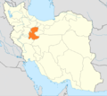
File:Locator map Iran Markazi Province.png
Appearance
Locator_map_Iran_Markazi_Province.png (672 × 600 pixels, file size: 131 KB, MIME type: image/png)
File history
Click on a date/time to view the file as it appeared at that time.
| Date/Time | Thumbnail | Dimensions | User | Comment | |
|---|---|---|---|---|---|
| current | 14:01, 23 June 2013 |  | 672 × 600 (131 KB) | BasilLeaf | بروزرسانی مرزها |
| 20:28, 3 September 2012 |  | 672 × 600 (135 KB) | Iranian engineer | more Filled. | |
| 19:28, 24 January 2011 |  | 672 × 600 (143 KB) | WikiDaisy | New version with Alborz province added. | |
| 10:51, 9 July 2010 |  | 672 × 600 (133 KB) | Dr. Blofeld~commonswiki | {{Information |Description={{en|1=k}} |Source=k |Author=k |Date=k |Permission= |other_versions= }} |
File usage
No pages on the English Wikipedia use this file (pages on other projects are not listed).
Global file usage
The following other wikis use this file:
- Usage on ar.wikipedia.org
- Usage on ast.wikipedia.org
- Usage on av.wikipedia.org
- Usage on azb.wikipedia.org
- Usage on be-tarask.wikipedia.org
- Usage on be.wikipedia.org
- Usage on ca.wikipedia.org
- Usage on ce.wikipedia.org
- Usage on crh.wikipedia.org
- Usage on diq.wikipedia.org
- Usage on eu.wikipedia.org
- Usage on fa.wikipedia.org
- استان مرکزی
- خمین
- ساوه
- محلات
- شازند
- تفرش
- اراک
- شهرستان اراک
- شهرستان تفرش
- شهرستان خمین
- شهرستان محلات
- سنجان (اراک)
- وفس
- نیمور
- شهرستان شازند
- شهرستان زرندیه
- آشتیان
- شهرستان دلیجان
- الگو:استان مرکزی
- دهستان خورهه
- شهرستان کمیجان
- داوودآباد
- هندودر
- آستانه (شازند)
- توره
- خنداب
- رازقان
- زاویه (زرندیه)
- غرقآباد
- فرمهین
- قورچیباشی (خمین)
- کرهرود
- کمیجان
- مأمونیه
- میلاجرد
- نوبران
- دلیجان (مرکزی)
- شهرستان آشتیان
- پرندک (زرندیه)
View more global usage of this file.


