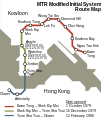
File:MIS route map en.svg
Appearance

Size of this PNG preview of this SVG file: 295 × 350 pixels. Other resolutions: 202 × 240 pixels | 404 × 480 pixels | 647 × 768 pixels | 863 × 1,024 pixels | 1,726 × 2,048 pixels.
Original file (SVG file, nominally 295 × 350 pixels, file size: 16 KB)
File history
Click on a date/time to view the file as it appeared at that time.
| Date/Time | Thumbnail | Dimensions | User | Comment | |
|---|---|---|---|---|---|
| current | 11:22, 7 March 2014 |  | 295 × 350 (16 KB) | Jc86035 | Moved Chater fully inside the image boundary |
| 10:20, 7 March 2014 |  | 295 × 350 (16 KB) | Jc86035 | Compressed, all paths now 5px wide, all text is now actually text | |
| 17:15, 4 July 2009 |  | 295 × 350 (322 KB) | Yarnalgo | removed black box | |
| 12:50, 2 July 2009 |  | 295 × 350 (320 KB) | Wylve | {{Information |Description=Hong Kong MTR MIS System Route Map English Version |Source=*File:MIS_route_map_eng.png |Date=2009-07-02 13:49 (UTC) |Author=*File:MIS_route_map_eng.png: User:Mtrkwt *derivative work: ~~~ |Permission=see below |o |
File usage
The following 2 pages use this file:
Global file usage
The following other wikis use this file:
- Usage on he.wikipedia.org
- Usage on id.wikipedia.org
- Usage on pt.wikipedia.org
- Usage on ru.wikipedia.org
- Usage on simple.wikipedia.org
- Usage on uk.wikipedia.org

