
File:MRT Station names.png
Size of this preview: 800 × 473 pixels. Other resolutions: 320 × 189 pixels | 640 × 379 pixels | 1,024 × 606 pixels | 1,280 × 757 pixels | 2,560 × 1,515 pixels | 5,408 × 3,200 pixels.
Original file (5,408 × 3,200 pixels, file size: 780 KB, MIME type: image/png)
Summary
[edit]
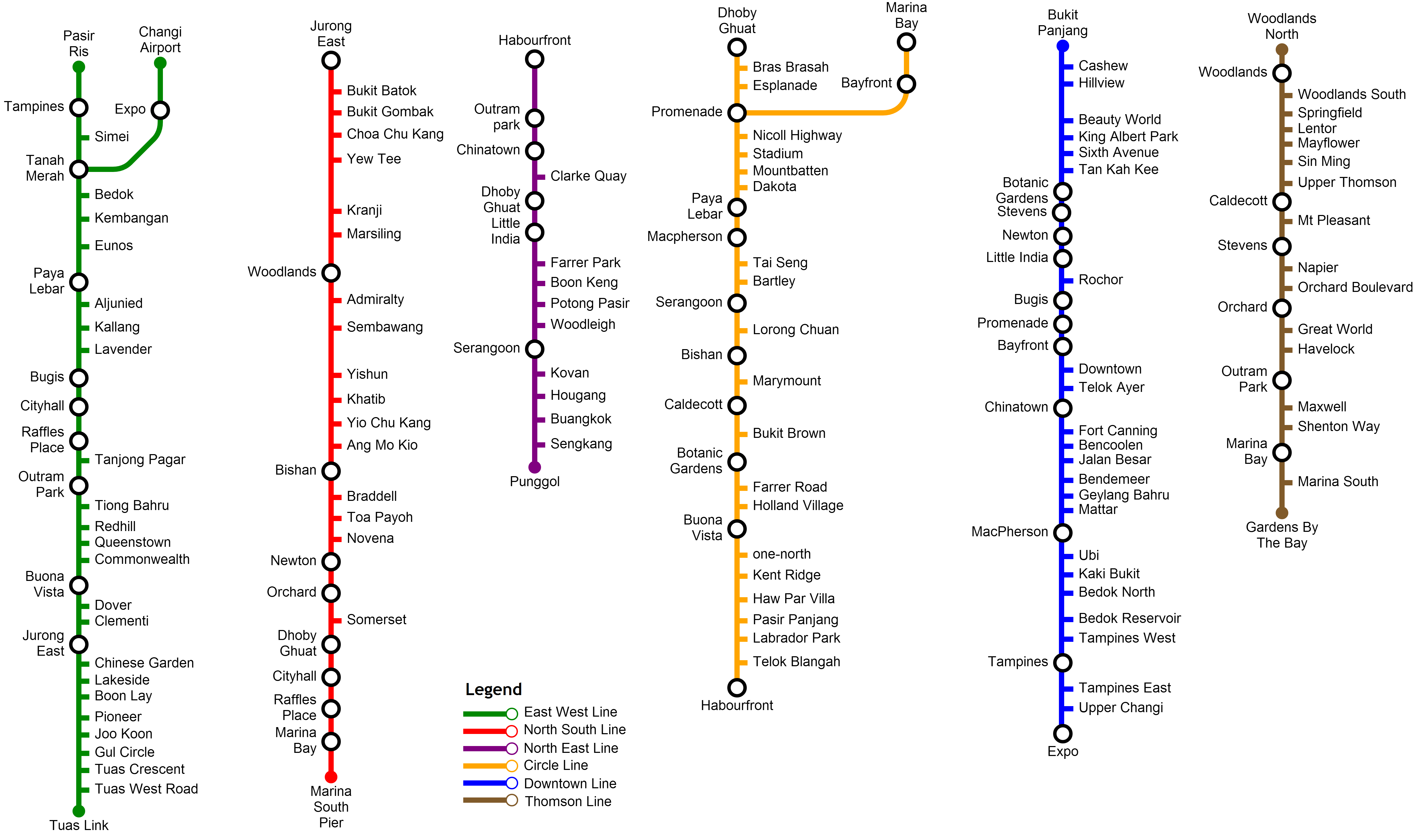
| Description |
List of MRT station names |
|---|---|
| Source |
Own work |
| Date |
2013-12-28 |
| Author | |
| Permission (Reusing this file) |
See below.
|
Licensing
[edit]
I, the copyright holder of this work, hereby publish it under the following license:
| This work is licensed under the Creative Commons Attribution 3.0 License. |
| This media file is either in the public domain or published under a free license, and contains no inbound file links. If this media file is useful, then it should be transferred to the Wikimedia Commons. If this media is not useful, then please propose it for deletion or list it at files for discussion. |
File history
Click on a date/time to view the file as it appeared at that time.
| Date/Time | Thumbnail | Dimensions | User | Comment | |
|---|---|---|---|---|---|
| current | 17:05, 28 December 2013 | | 5,408 × 3,200 (780 KB) | Josephsolomon92 (talk | contribs) | Added Thomson Line, Updated with Stevens, Caldecott, Woodlands, Orchard as interchange, added Bukit Brown in the Circle Line. |
| 15:57, 28 December 2013 |  | 4,840 × 3,496 (678 KB) | Josephsolomon92 (talk | contribs) | Uploading a self-made file using File Upload Wizard |
You cannot overwrite this file.
File usage
No pages on the English Wikipedia use this file (pages on other projects are not listed).