
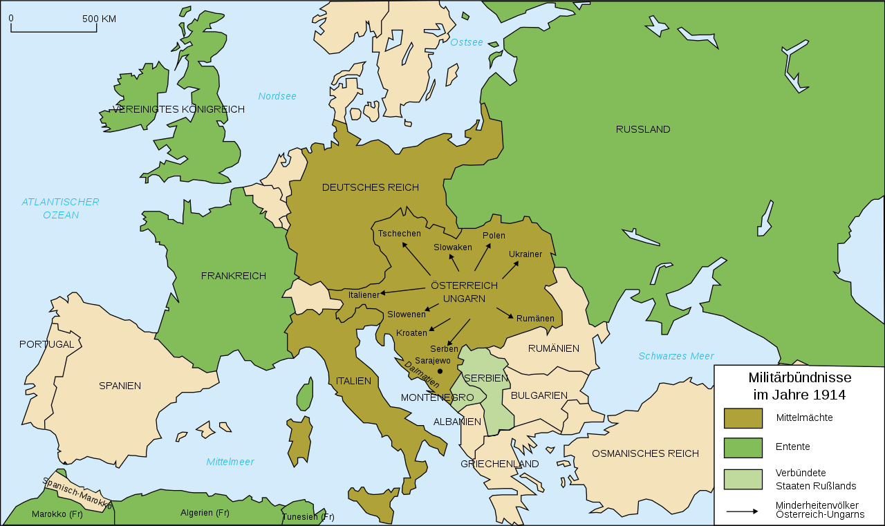
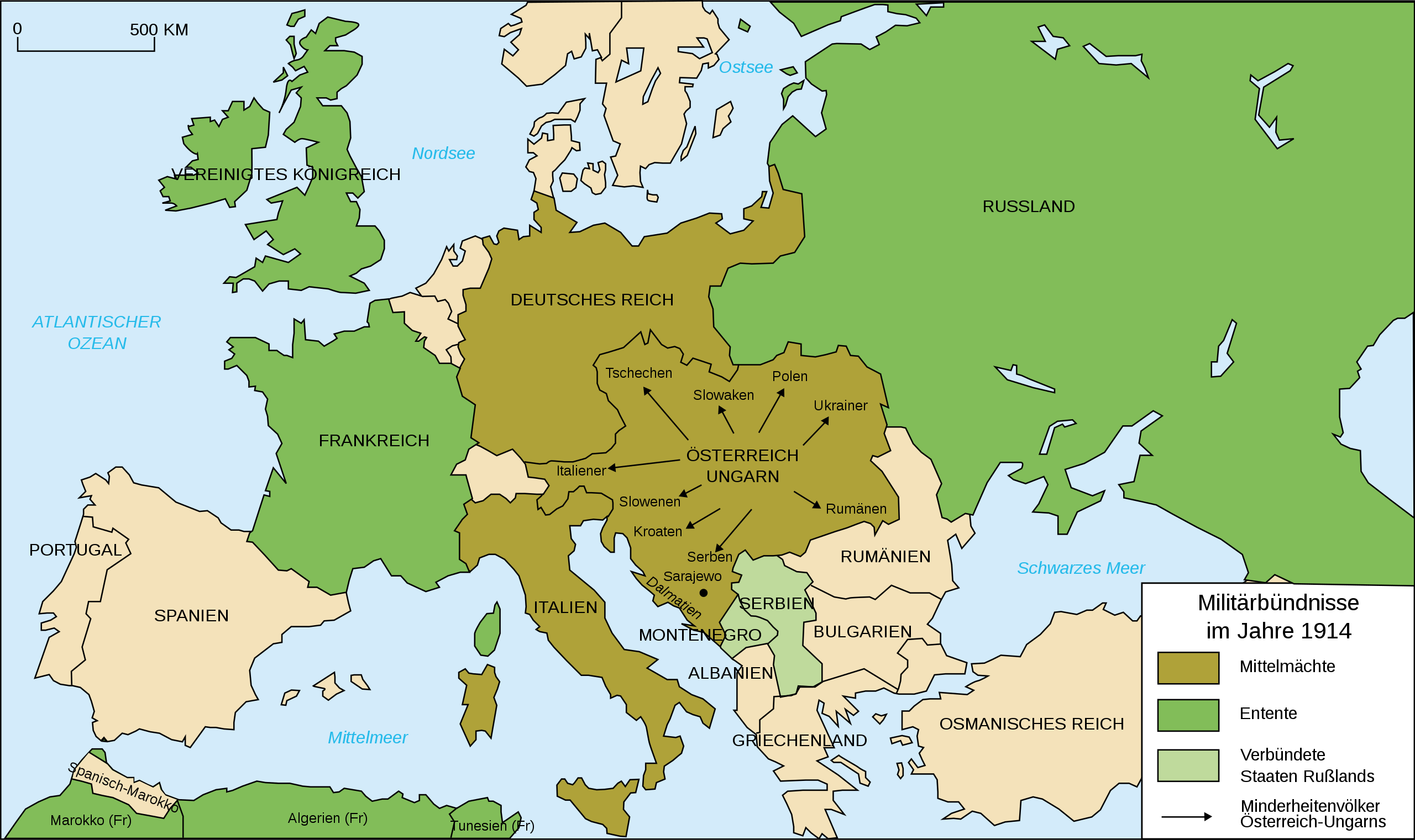
File:Map Europe alliances 1914-de.svg

Size of this PNG preview of this SVG file: 800 × 475 pixels. Other resolutions: 320 × 190 pixels | 640 × 380 pixels | 1,024 × 608 pixels | 1,280 × 761 pixels | 2,560 × 1,521 pixels | 998 × 593 pixels.
Original file (SVG file, nominally 998 × 593 pixels, file size: 124 KB)
| This is a file from the Wikimedia Commons. Information from its description page there is shown below. Commons is a freely licensed media file repository. You can help. |
| Description |
Deutsch: Karte von Militärbündnisse in Europa in 1914, (deutsch)
English: Map of military alliances of Europe in 1914. (German)
Français : Carte des alliances militaires en Europe en 1914 (Allemagne).
Русский: Схема военных альянсов в Европе в 1914 г. (нем.) |
| Date | (UTC) |
| Source | |
| Author |
|
| Other versions |
Derivative works of this file: Map Europe alliances 1914-sv.svg
[] .gif)
|


| This is a retouched picture, which means that it has been digitally altered from its original version. Modifications: Into German, auf deutsch. The original can be viewed here: Map Europe alliances 1914-fr.svg:
|
I, the copyright holder of this work, hereby publish it under the following license:
This file is licensed under the Creative Commons Attribution-Share Alike 2.5 Generic, 2.0 Generic and 1.0 Generic license.
- You are free:
- to share – to copy, distribute and transmit the work
- to remix – to adapt the work
- Under the following conditions:
- attribution – You must give appropriate credit, provide a link to the license, and indicate if changes were made. You may do so in any reasonable manner, but not in any way that suggests the licensor endorses you or your use.
- share alike – If you remix, transform, or build upon the material, you must distribute your contributions under the same or compatible license as the original.
Original upload log
This image is a derivative work of the following images:
- Image:Map_Europe_alliances_1914-fr.svg licensed with Cc-by-sa-2.5,2.0,1.0
- 2007-02-26T23:36:35Z Bibi Saint-Pol 998x593 (100171 Bytes) {{Information |Description= {{fr|Carte des alliances militaires en Europe en 1914.}} |Source=Création personnelle (version renommée de [[:Image:Les rivalités en Europe en 1914.svg]]) |Date=2006-10-31 |Author=[[User:Histori
Uploaded with derivativeFX
File history
Click on a date/time to view the file as it appeared at that time.
| Date/Time | Thumbnail | Dimensions | User | Comment | |
|---|---|---|---|---|---|
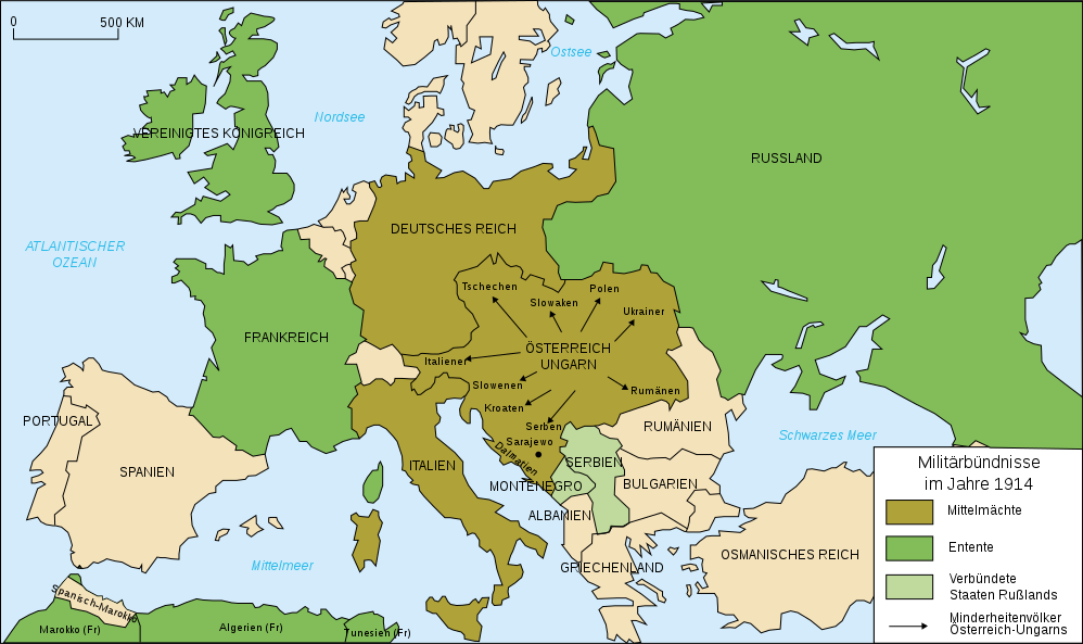
| current | 20:34, 1 February 2020 | | 998 × 593 (124 KB) | Radek Linner | File uploaded using svgtranslate tool (https://tools.wmflabs.org/svgtranslate/). Added translation for cs. |
| 21:15, 30 November 2015 |  | 998 × 593 (98 KB) | Turnless | Russian islands | |
| 11:14, 19 July 2010 |  | 998 × 593 (98 KB) | KaterBegemot | Minor graphical corrections. "Militärbündnisse in 1914" was a incorrect translation. | |
| 22:25, 25 January 2009 |  | 998 × 593 (100 KB) | Tinloaf | Fixing some spelling mistakes. | |
| 02:00, 4 October 2008 |  | 998 × 593 (98 KB) | Danbornekde~commonswiki | {{Information |Description={{fr|Carte des alliances militaires en Europe en 1914.}} Karte von Militärbündnisse in Europa in 1914, deutsch |Source=*Image:Map_Europe_alliances_1914-fr.svg |Date=2008-10-04 01:57 (UTC) |Author=*derivative work: ~~~ * |
File usage
No pages on the English Wikipedia use this file (pages on other projects are not listed).
Global file usage
The following other wikis use this file:
- Usage on de.wikipedia.org
- Usage on nds.wikipedia.org
- Usage on rm.wikipedia.org
- Usage on zh.wikipedia.org