
File:Map of CSA 3.png
Size of this preview: 800 × 405 pixels. Other resolutions: 320 × 162 pixels | 640 × 324 pixels | 1,024 × 518 pixels | 1,800 × 911 pixels.
Original file (1,800 × 911 pixels, file size: 947 KB, MIME type: image/png)
| This is a file from the Wikimedia Commons. Information from its description page there is shown below. Commons is a freely licensed media file repository. You can help. |
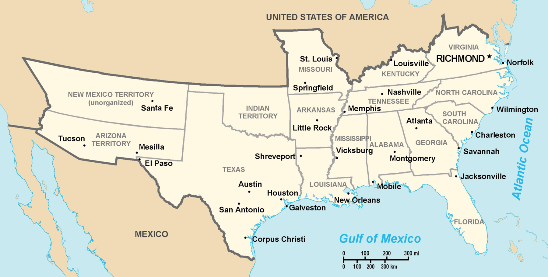
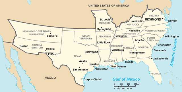
Theoretical territory map of Confederate States (much of Missouri, Kentucky, West Virginia and far western areas were never under effective Confederate control), Created by Nicholas Forte
(del) (cur) 00:53, 16 August 2005 . . Nicholas F . . 1800x911 (969382 bytes) (Created by Nicholas Forte )
This image is in the public domain because it contains materials that originally came from the United States Central Intelligence Agency's World Factbook.
|
 |
derivative works
Derivative works of this file: Map of CSA - Georgia highlighted.png
File history
Click on a date/time to view the file as it appeared at that time.
| Date/Time | Thumbnail | Dimensions | User | Comment | |
|---|---|---|---|---|---|
| current | 18:20, 7 December 2005 | | 1,800 × 911 (947 KB) | Walden69 | Map of Confederate States Created by Nicholas Forte This image has been released into the public domain by the copyright holder, its copyright has expired, or it is ineligible for copyright. This applies worldwide. Subject to disclaimers. File history L |
File usage
No pages on the English Wikipedia use this file (pages on other projects are not listed).
Global file usage
The following other wikis use this file:
- Usage on azb.wikipedia.org
- Usage on fr.wikipedia.org
- Usage on nn.wikipedia.org
- Usage on no.wikipedia.org