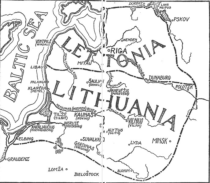
File:Map of Lithuania-Latvia by Šliūpas.jpg
Appearance

Size of this preview: 687 × 600 pixels. Other resolutions: 275 × 240 pixels | 550 × 480 pixels | 880 × 768 pixels | 1,214 × 1,060 pixels.
Original file (1,214 × 1,060 pixels, file size: 198 KB, MIME type: image/jpeg)
File history
Click on a date/time to view the file as it appeared at that time.
| Date/Time | Thumbnail | Dimensions | User | Comment | |
|---|---|---|---|---|---|
| current | 13:09, 27 January 2019 |  | 1,214 × 1,060 (198 KB) | Renata3 | {{Information |Description= Map of Lithuania–Latvia state as envisioned and proposed by Jonas Šliūpas |Source= [https://books.google.com/books?id=jyE7AQAAIAAJ ''Lithuania in retrospect and prospect'', pages 16–17] (via Google Books) |Date= 1915 |Author= Jonas Šliūpas |Permission= PD |other_versions= }} Category:Jonas Šliūpas Category:Maps of Lithuania under Russian and German empires (1795-1918) |
File usage
The following page uses this file:
