
File:Map of Tibet in the 13th century and Central Asian trade routes (cropped).jpg

No higher resolution available.
Map_of_Tibet_in_the_13th_century_and_Central_Asian_trade_routes_(cropped).jpg (608 × 212 pixels, file size: 77 KB, MIME type: image/jpeg)
| This is a file from the Wikimedia Commons. Information from its description page there is shown below. Commons is a freely licensed media file repository. You can help. |
Summary
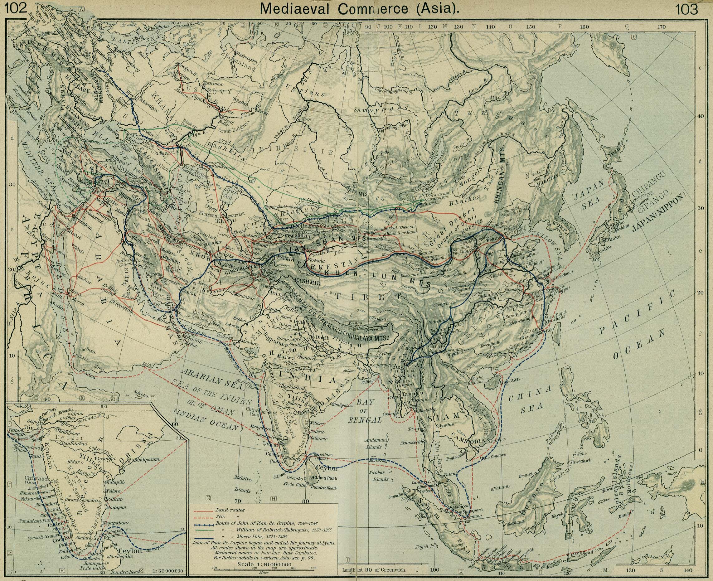
| Description | Mediaeval trade routes in central Asia. Modified map based on Sheherd Mediaeval Commerce (1923/first edition 1911) | |||||||||||||||||||||||
| Source |
From the "Historical Atlas" by William R. Shepherd, New York, Henry Holt and Company, 1923 (2nd edition) |
|||||||||||||||||||||||
| Author |
|
|||||||||||||||||||||||
| Other versions | ||||||||||||||||||||||||
.png)

.jpg)
Licensing
|
This work is in the public domain in its country of origin and other countries and areas where the copyright term is the author's life plus 70 years or fewer. | |
| This file has been identified as being free of known restrictions under copyright law, including all related and neighboring rights. | |
| Annotations | This image is annotated: View the annotations at Commons |
File history
Click on a date/time to view the file as it appeared at that time.
| Date/Time | Thumbnail | Dimensions | User | Comment | |
|---|---|---|---|---|---|
| current | 15:55, 20 March 2019 | 608 × 212 (77 KB) | Tibet Nation | File:Central Asian trade routes V2.jpg cropped 53 % horizontally, 75 % vertically using CropTool with lossless mode. |
File usage
The following pages on the English Wikipedia use this file (pages on other projects are not listed):
Global file usage
The following other wikis use this file:
- Usage on ca.wikipedia.org
- Usage on es.wikipedia.org
- Usage on sr.wikipedia.org
- Usage on sw.wikipedia.org
.jpg)