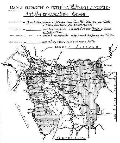
File:Map of plebiscite area.jpg
Appearance
Map_of_plebiscite_area.jpg (499 × 593 pixels, file size: 100 KB, MIME type: image/jpeg)
File history
Click on a date/time to view the file as it appeared at that time.
| Date/Time | Thumbnail | Dimensions | User | Comment | |
|---|---|---|---|---|---|
| current | 14:03, 14 August 2008 |  | 499 × 593 (100 KB) | MonkeymanT | {{Information |Description={{en|1=Map of the plebiscite area of Teschen Silesia during the dispute between Czechoslovakia and Poland over Teschen Silesia in 1918 - 1920. The descriptions on the map are in Czech.}} |Source=Dr. Ferdinand Pelc: O Těšínsko |
File usage
The following page uses this file:
Global file usage
The following other wikis use this file:
- Usage on cs.wikipedia.org
- Usage on de.wikipedia.org
- Usage on eo.wikipedia.org
- Usage on es.wikipedia.org
- Usage on fr.wikipedia.org
- Usage on it.wikipedia.org
- Usage on ja.wikipedia.org
- Usage on pt.wikipedia.org
- Usage on ro.wikipedia.org
- Usage on sh.wikipedia.org
- Usage on sk.wikipedia.org
- Usage on uk.wikipedia.org
- Usage on www.wikidata.org

