
File:McRoberts Island (Sea Island) Map 1965.jpg

Size of this preview: 678 × 600 pixels. Other resolutions: 271 × 240 pixels | 543 × 480 pixels | 869 × 768 pixels | 1,158 × 1,024 pixels | 2,316 × 2,048 pixels | 4,198 × 3,712 pixels.
Original file (4,198 × 3,712 pixels, file size: 1.8 MB, MIME type: image/jpeg)
| This is a file from the Wikimedia Commons. Information from its description page there is shown below. Commons is a freely licensed media file repository. You can help. |
_Map_1965.jpg)
Summary
| Description |
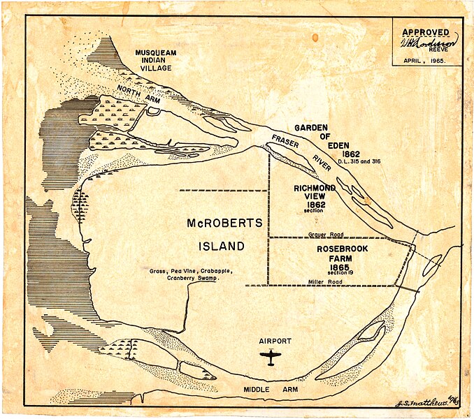
English: 1965 map of Sea Island, then known as McRoberts Island, drawn by Major J.S. Matthews, City Archivist for Vancouver. Authenticated by W.H. Anderson, Reeve of Richmond District. |
| Date | |
| Source |
City of Vancouver Archives https://searcharchives.vancouver.ca/mcroberts-island |
| Author | Major James Skitt Matthews |
Licensing
| This file is made available under the Creative Commons CC0 1.0 Universal Public Domain Dedication. | |
| The person who associated a work with this deed has dedicated the work to the public domain by waiving all of their rights to the work worldwide under copyright law, including all related and neighboring rights, to the extent allowed by law. You can copy, modify, distribute and perform the work, even for commercial purposes, all without asking permission.
|
File history
Click on a date/time to view the file as it appeared at that time.
| Date/Time | Thumbnail | Dimensions | User | Comment | |
|---|---|---|---|---|---|
| current | 03:57, 25 May 2024 | | 4,198 × 3,712 (1.8 MB) | GentleHillRacer | Uploaded a work by Major James Skitt Matthews from City of Vancouver Archives https://searcharchives.vancouver.ca/mcroberts-island with UploadWizard |
File usage
The following pages on the English Wikipedia use this file (pages on other projects are not listed):
_Map_1965.jpg)