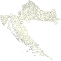
File:Municipalities of Croatia.svg
Appearance

Size of this PNG preview of this SVG file: 600 × 600 pixels. Other resolutions: 240 × 240 pixels | 480 × 480 pixels | 768 × 768 pixels | 1,024 × 1,024 pixels | 2,048 × 2,048 pixels | 900 × 900 pixels.
Original file (SVG file, nominally 900 × 900 pixels, file size: 3.29 MB)
File history
Click on a date/time to view the file as it appeared at that time.
| Date/Time | Thumbnail | Dimensions | User | Comment | |
|---|---|---|---|---|---|
| current | 22:05, 12 January 2020 |  | 900 × 900 (3.29 MB) | Tezwoo | new map with more accurate borders |
| 23:03, 1 January 2020 |  | 900 × 892 (2.93 MB) | Tezwoo | Updated villages: -Donje Dvorišće (from Brckovljani to Dugo Selo) -Hruškovica (from Preseka to Vrbovec) -Kupina (from Oprisavci to Velika Kopanica) -Novi Čeminac (from Jagodnjak to Čeminac) -Eržišće (from Kršan to Sveta Nedelja) -Šušnjevci (from Garčin to Bukovlje) | |
| 19:59, 27 May 2019 |  | 900 × 892 (3.14 MB) | Tezwoo | update for two villages that changed municipality in 2013 | |
| 14:38, 2 March 2019 |  | 900 × 892 (2.81 MB) | Tezwoo | User created page with UploadWizard |
File usage
The following 2 pages use this file:
Global file usage
The following other wikis use this file:
- Usage on cs.wikipedia.org
- Usage on es.wikipedia.org
- Usage on fr.wikipedia.org
- Usage on hr.wikipedia.org
- Usage on mk.wikipedia.org
- Usage on ru.wikipedia.org
- Usage on sl.wikipedia.org
- Usage on sr.wikipedia.org
- Usage on tr.wikipedia.org
- Usage on uk.wikipedia.org
