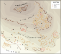
File:Map of Mystras-en.svg
Appearance

Size of this PNG preview of this SVG file: 732 × 571 pixels. Other resolutions: 308 × 240 pixels | 615 × 480 pixels | 985 × 768 pixels | 1,280 × 998 pixels | 2,560 × 1,997 pixels.
Original file (SVG file, nominally 732 × 571 pixels, file size: 264 KB)
File history
Click on a date/time to view the file as it appeared at that time.
| Date/Time | Thumbnail | Dimensions | User | Comment | |
|---|---|---|---|---|---|
| current | 14:37, 6 September 2013 |  | 732 × 571 (264 KB) | Cplakidas | rmv whitespace, text to paths |
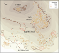
| 07:07, 26 March 2008 |  | 850 × 651 (1.49 MB) | Marsyas | {{Information |Description= |Source=self-made |Date= |Author= Marsyas |Permission= |other_versions= }} | |
| 07:03, 26 March 2008 |  | 850 × 651 (2 MB) | Marsyas | == Summary == {{Information |Description=Plan de Mistra d'après le relevé de G. Millet (1910) revu par M. Chatzidakis (1981). Légende : 1. Entrée principale ; 2. Métropole ; 3. Évangélistria ; 4. Saints-Théodores ; 5. Hodigitria-Afendiko ; 6. Port |
File usage
The following page uses this file:
Global file usage
The following other wikis use this file:
- Usage on de.wikipedia.org
- Usage on de.wikivoyage.org
- Usage on eo.wikipedia.org
- Usage on fi.wikipedia.org
- Usage on hr.wikipedia.org
- Usage on mt.wikipedia.org
- Usage on sh.wikipedia.org
- Usage on sl.wikipedia.org
- Usage on tr.wikipedia.org
- Usage on zh.wikipedia.org


