
File:NOAA map of Duck Galloo Ridge.jpg
Size of this preview: 736 × 599 pixels. Other resolutions: 295 × 240 pixels | 590 × 480 pixels | 943 × 768 pixels | 1,258 × 1,024 pixels | 2,515 × 2,048 pixels | 2,736 × 2,228 pixels.
Original file (2,736 × 2,228 pixels, file size: 3.47 MB, MIME type: image/jpeg)
| This is a file from the Wikimedia Commons. Information from its description page there is shown below. Commons is a freely licensed media file repository. You can help. |
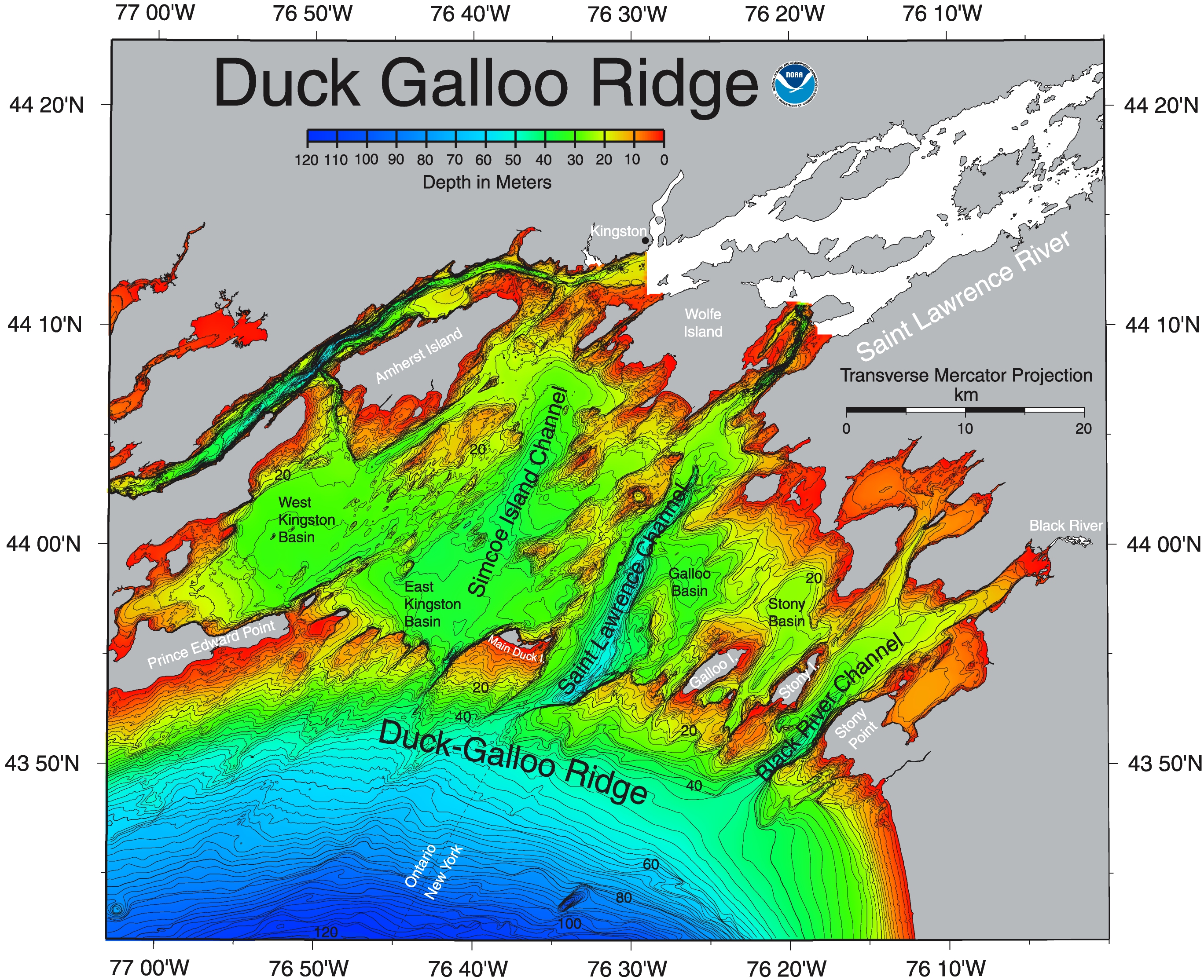
| Description | This NOAA map of Duck Galloo Ridge shows the Northeast corner of Lake Ontario. As lakes go Lake Ontario is relatively deep. The portion north of this ridge is significantly less deep. | |||
| Source | https://ngdc.noaa.gov/mgg/greatlakes/lakeontario_cdrom/html/newnames.htm | |||
| Author | ||||
| Permission (Reusing this file) |
|
|||
| Other versions |
_showing_Timber,_Swetman,_Main_Duck_and_Yorkshire_islands,_and_some_subsurface_shoals.jpg)
File history
Click on a date/time to view the file as it appeared at that time.
| Date/Time | Thumbnail | Dimensions | User | Comment | |
|---|---|---|---|---|---|
| current | 01:14, 23 June 2017 | | 2,736 × 2,228 (3.47 MB) | Geo Swan | {{Information |Description=This {{w|NOAA}} map of {{w|Duck Galloo Ridge}} shows the Northeast corner of {{w|Lake Ontario}}. As lakes go Lake Ontario is relatively deep. The portion north of this ridge is significantly less deep. |Source=https://ngdc.... |
File usage
The following pages on the English Wikipedia use this file (pages on other projects are not listed):
Global file usage
The following other wikis use this file:
- Usage on ceb.wikipedia.org
- Usage on www.wikidata.org