
File:NPS isle-royale-national-park-map.jpg

Size of this preview: 800 × 479 pixels. Other resolutions: 320 × 192 pixels | 640 × 383 pixels | 1,024 × 613 pixels | 1,280 × 766 pixels | 2,560 × 1,532 pixels | 3,564 × 2,133 pixels.
Original file (3,564 × 2,133 pixels, file size: 875 KB, MIME type: image/jpeg)
| This is a file from the Wikimedia Commons. Information from its description page there is shown below. Commons is a freely licensed media file repository. You can help. |
Summary
| Description |
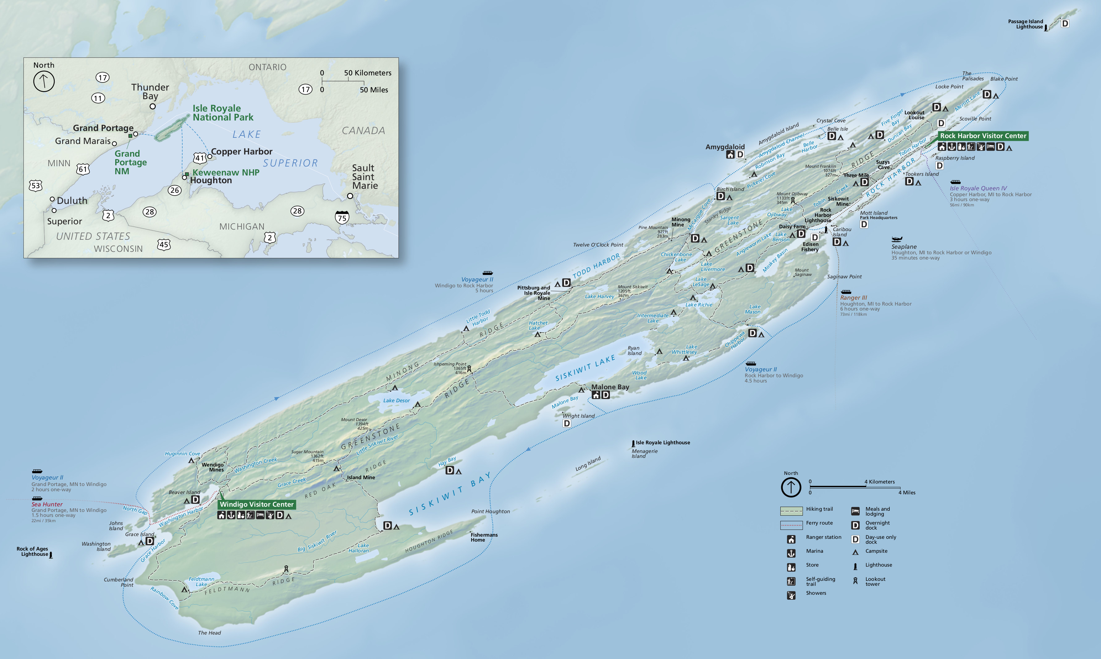
English: This the new 2016 Isle Royale map, combining the two maps below into one with new graphics, labels, and orientation. I think it looks a bit nicer and has a less cartoony look. |
| Date | |
| Source | U.S. National Park Service (http://npmaps.com/wp-content/uploads/isle-royale-national-park-map.jpg) |
| Author | U.S. National Park Service, restoration/cleanup by Matt Holly |
Licensing
| This image or media file contains material based on a work of a National Park Service employee, created as part of that person's official duties. As a work of the U.S. federal government, such work is in the public domain in the United States. See the NPS website and NPS copyright policy for more information. |
File history
Click on a date/time to view the file as it appeared at that time.
| Date/Time | Thumbnail | Dimensions | User | Comment | |
|---|---|---|---|---|---|
| current | 23:48, 16 May 2017 | | 3,564 × 2,133 (875 KB) | RKBot | =={{int:filedesc}}== {{Information |description= {{en|1=This the new 2016 Isle Royale map, combining the two maps below into one with new graphics, labels, and orientation. I think it looks a bit nicer and has a less cartoony look.}} |date= 2017-01-22... |
File usage
No pages on the English Wikipedia use this file (pages on other projects are not listed).
Global file usage
The following other wikis use this file:
- Usage on ban.wikipedia.org
- Usage on zh.wikipedia.org