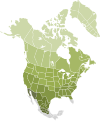
File:Nearctic-Ecozone-Biocountries-2-IM.svg
Appearance

Size of this PNG preview of this SVG file: 452 × 544 pixels. Other resolutions: 199 × 240 pixels | 399 × 480 pixels | 638 × 768 pixels | 851 × 1,024 pixels | 1,702 × 2,048 pixels.
Original file (SVG file, nominally 452 × 544 pixels, file size: 381 KB)
File history
Click on a date/time to view the file as it appeared at that time.
| Date/Time | Thumbnail | Dimensions | User | Comment | |
|---|---|---|---|---|---|
| current | 04:05, 27 July 2008 |  | 452 × 544 (381 KB) | CarolSpears | |
| 20:23, 26 July 2008 |  | 452 × 545 (380 KB) | CarolSpears | rest of border removed | |
| 00:17, 30 April 2008 |  | 452 × 545 (381 KB) | CarolSpears | xml is cleaner, border removed from alaska and Mexico has three divisions now | |
| 14:29, 29 April 2008 |  | 452 × 544 (402 KB) | CarolSpears | {{Information |Description=Smaller version of Ecozone-Biocountries-Nearctic-2 to use for wiki image maps. |Source=Selected from Ecozones and [[:Image:North America second level political divis |
File usage
The following page uses this file:


