
File:OHMap-doton-CairoStark.png
No higher resolution available.
OHMap-doton-CairoStark.png (309 × 352 pixels, file size: 17 KB, MIME type: image/png)
| This is a file from the Wikimedia Commons. Information from its description page there is shown below. Commons is a freely licensed media file repository. You can help. |
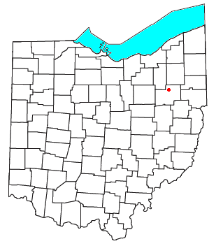
| Description | Locator map of the unincorporated community of Cairo in Stark County, Ohio, United States. | ||
| Date | |||
| Source | Modified from this United States Census Bureau file. | ||
| Author | User:Nyttend | ||
| Permission (Reusing this file) |
US Government work is public domain, and my work is
|
File history
Click on a date/time to view the file as it appeared at that time.
| Date/Time | Thumbnail | Dimensions | User | Comment | |
|---|---|---|---|---|---|
| current | 05:29, 8 June 2008 | | 309 × 352 (17 KB) | Nyttend | {{Information |Description=Locator map of the {{w|unincorporated area|unincorporated community}} of {{w|Cairo, Stark County, Ohio|Cairo}} in {{w|Stark County, Ohio|Stark County}}, {{w|Ohio}}, {{w|United States}}. |Source=Modified from [http://www2.census. |
File usage
The following pages on the English Wikipedia use this file (pages on other projects are not listed):
Global file usage
The following other wikis use this file:
- Usage on fa.wikipedia.org
- Usage on www.wikidata.org