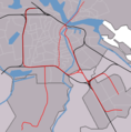
File:Outline map Amsterdam metro 2.PNG
Appearance

Size of this preview: 592 × 599 pixels. Other resolutions: 237 × 240 pixels | 474 × 480 pixels | 952 × 964 pixels.
Original file (952 × 964 pixels, file size: 136 KB, MIME type: image/png)
File history
Click on a date/time to view the file as it appeared at that time.
| Date/Time | Thumbnail | Dimensions | User | Comment | |
|---|---|---|---|---|---|
| current | 14:45, 11 August 2007 |  | 952 × 964 (136 KB) | Michiel1972 | == Summary == {{Information |Description=outline map Amsterdam metro/railways |Source=self-made, background based on Image:Map NL - Amsterdam - .png, see also image:Outline_map_Amsterdam_metro_2.PNG for version without North/South line |Date=aug |
File usage
The following 28 pages use this file:
- Amstelveen Centrum tram stop
- Amstelveenseweg metro station
- Amsterdam Centraal station
- Amsterdam Lelylaan station
- Amsterdam RAI station
- Amsterdam Zuid station
- De Boelelaan/VU tram stop
- De Pijp metro station
- De Vlugtlaan metro station
- Europaplein metro station
- Gondel tram stop
- Heemstedestraat metro station
- Henk Sneevlietweg metro station
- Jan van Galenstraat metro station
- Kronenburg tram stop
- Marne tram stop
- Noord metro station
- Noorderpark metro station
- Onderuit tram stop
- Oranjebaan tram stop
- Postjesweg metro station
- Rokin metro station
- Uilenstede tram stop
- Van Boshuizenstraat tram stop
- Vijzelgracht metro station
- Zonnestein tram stop
- Module:Location map/data/Netherlands Amsterdam metro station
- Module:Location map/data/Netherlands Amsterdam metro station/doc
Global file usage
The following other wikis use this file:
- Usage on ar.wikipedia.org
- Usage on ca.wikipedia.org
- Usage on ceb.wikipedia.org
- Usage on eo.wikipedia.org
- Greenpeace
- Gein (amsterdama metrostacio)
- Isolatorweg (amsterdama metrostacio)
- Westwijk (amsterdama metrostacio)
- Gaasperplas (amsterdama metrostacio)
- Noord (amsterdama metrostacio)
- Nieuwmarkt (amsterdama metrostacio)
- Waterlooplein (amsterdama metrostacio)
- Weesperplein (amsterdama metrostacio)
- Wibautstraat (amsterdama metrostacio)
- Spaklerweg (amsterdama metrostacio)
- Van der Madeweg (amsterdama metrostacio)
- Overamstel (amsterdama metrostacio)
- Bullewijk (amsterdama metrostacio)
- Reigersbos (amsterdama metrostacio)
- Strandvliet (amsterdama metrostacio)
- De Boelelaan/VU (amsterdama metrostacio)
- A.J. Ernststraat (amsterdama metrostacio)
- Van Boshuizenstraat (amsterdama metrostacio)
- Uilenstede (amsterdama metrostacio)
- Kronenburg (amsterdama metrostacio)
- Zonnestein (amsterdama metrostacio)
- Onderuit (amsterdama metrostacio)
- Oranjebaan (amsterdama metrostacio)
- Amstelveen Centrum (amsterdama metrostacio)
- Ouderkerkerlaan (amsterdama metrostacio)
- Sportlaan (amsterdama metrostacio)
- Marne (amsterdama metrostacio)
- Gondel (amsterdama metrostacio)
- Meent (amsterdama metrostacio)
- Brink (amsterdama metrostacio)
- Poortwachter (amsterdama metrostacio)
- Spinnerij (amsterdama metrostacio)
- Sacharovlaan (amsterdama metrostacio)
- Noorderpark (amsterdama metrostacio)
- Rokin (amsterdama metrostacio)
- Vijzelgracht (amsterdama metrostacio)
- De Pijp (amsterdama metrostacio)
- Europaplein (amsterdama metrostacio)
- Sixhaven (amsterdama metrostacio)
- Venserpolder (amsterdama metrostacio)
- Verrijn Stuartweg (amsterdama metrostacio)
- Ganzenhoef (amsterdama metrostacio)
- Kraaiennest (amsterdama metrostacio)
- De Vlugtlaan (amsterdama metrostacio)
- Jan van Galenstraat (amsterdama metrostacio)
- Postjesweg (amsterdama metrostacio)
View more global usage of this file.

