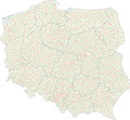
File:POLSKA woj pow gminy.png
Appearance

Size of this preview: 646 × 600 pixels. Other resolutions: 259 × 240 pixels | 517 × 480 pixels | 827 × 768 pixels | 1,103 × 1,024 pixels | 2,041 × 1,895 pixels.
Original file (2,041 × 1,895 pixels, file size: 1.6 MB, MIME type: image/png)
File history
Click on a date/time to view the file as it appeared at that time.
| Date/Time | Thumbnail | Dimensions | User | Comment | |
|---|---|---|---|---|---|
| current | 17:36, 25 January 2016 |  | 2,041 × 1,895 (1.6 MB) | Aotearoa | drobna korekta (uzupełnienie przerwanych granic) |
| 14:41, 21 March 2015 |  | 2,041 × 1,895 (1.71 MB) | Aotearoa | Mapa przedstawia stan na 2008 rok, a wtedy Wałbrzych nie był wydzielony | |
| 14:18, 20 March 2015 |  | 2,041 × 1,895 (1.69 MB) | Blackfish | Wałbrzych | |
| 10:12, 19 May 2009 |  | 2,041 × 1,895 (1.71 MB) | Aotearoa | drobna korekta | |
| 07:20, 10 April 2008 |  | 2,041 × 1,895 (1.6 MB) | Aotearoa | ||
| 20:35, 5 February 2007 |  | 2,041 × 1,895 (1.71 MB) | Aotearoa | ||
| 18:34, 5 February 2007 |  | 2,041 × 1,895 (1.73 MB) | Aotearoa | Mapa administracyjna Polski z zaznaczonymi granicami województw, gmin i powiatów. Autor: Aotearoa<br> Administrative map of Poland with borders of województwa (voivodships), powiaty (counties) and gminy (communes). By [[User:Aotearoa| |
File usage
The following page uses this file:
Global file usage
The following other wikis use this file:
- Usage on ar.wikipedia.org
- Usage on be-tarask.wikipedia.org
- Usage on be.wikipedia.org
- Usage on bxr.wikipedia.org
- Usage on de.wikipedia.org
- Usage on eo.wikipedia.org
- Usage on et.wikipedia.org
- Usage on fr.wikipedia.org
- Usage on hu.wikipedia.org
- Usage on hy.wikipedia.org
- Usage on ky.wikipedia.org
- Usage on ltg.wikipedia.org
- Usage on lt.wikipedia.org
- Usage on lv.wikipedia.org
- Usage on pl.wikipedia.org
- Usage on pt.wikipedia.org
- Usage on ru.wikipedia.org
- Usage on xmf.wikipedia.org


