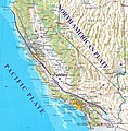
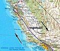
File:Parkfieldcapos.jpg
Appearance

Size of this preview: 589 × 600 pixels. Other resolutions: 236 × 240 pixels | 472 × 480 pixels | 754 × 768 pixels | 1,170 × 1,191 pixels.
Original file (1,170 × 1,191 pixels, file size: 955 KB, MIME type: image/jpeg)
File history
Click on a date/time to view the file as it appeared at that time.
| Date/Time | Thumbnail | Dimensions | User | Comment | |
|---|---|---|---|---|---|
| current | 22:58, 24 May 2019 |  | 1,170 × 1,191 (955 KB) | Gretarsson | larger and much better resoluted file with complete extent of San Andreas Fault plus some of its major fault branches, according to https://earthquake.usgs.gov/learn/topics/safz-paleo/images/camap.gif |
| 20:23, 29 June 2006 |  | 850 × 713 (79 KB) | SMi | == Beschreibung == * Bildbeschreibung: Ausschnitt der Referenzkarte des US-Bundesstaates Kalifornien mit hervorgehobener Position der Ortschaft Parkfield, nachbearbeitet von mir selbst (so1eda) * Quelle: [http://de.wikipedia.org/wiki/Kalifornien Wikip |
File usage
No pages on the English Wikipedia use this file (pages on other projects are not listed).
Global file usage
The following other wikis use this file:
- Usage on de.wikipedia.org
