
File:Parkside Area near Newton-le-Willows, St Helens, England.svg

Size of this PNG preview of this SVG file: 800 × 596 pixels. Other resolutions: 320 × 239 pixels | 640 × 477 pixels | 1,024 × 763 pixels | 1,280 × 954 pixels | 2,560 × 1,908 pixels | 2,309 × 1,721 pixels.
Original file (SVG file, nominally 2,309 × 1,721 pixels, file size: 4.33 MB)
| This is a file from the Wikimedia Commons. Information from its description page there is shown below. Commons is a freely licensed media file repository. You can help. |
Summary
| Description |
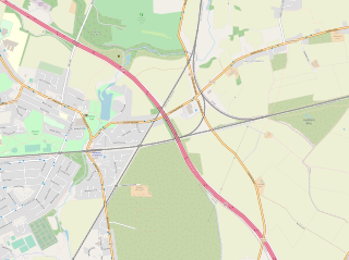
English: Map showing the area around Parkside railway junctions and former station sites |
|||||||||||||||
| Date | ||||||||||||||||
| Source | https://www.openstreetmap.org | |||||||||||||||
| Author |
|
| Camera location | | View this and other nearby images on: OpenStreetMap |
|---|
Licensing
Open Data Commons Open Database License
File history
Click on a date/time to view the file as it appeared at that time.
| Date/Time | Thumbnail | Dimensions | User | Comment | |
|---|---|---|---|---|---|
| current | 09:22, 3 August 2020 | | 2,309 × 1,721 (4.33 MB) | Nempnet | Uploaded a work by {{Openstreetmap}} from https://www.openstreetmap.org with UploadWizard |
File usage
The following pages on the English Wikipedia use this file (pages on other projects are not listed):