File:PenobscotExpedition1779.jpg
Appearance

Size of this preview: 622 × 600 pixels. Other resolutions: 249 × 240 pixels | 498 × 480 pixels | 796 × 768 pixels | 1,062 × 1,024 pixels | 2,124 × 2,048 pixels | 3,588 × 3,460 pixels.
Original file (3,588 × 3,460 pixels, file size: 5.89 MB, MIME type: image/jpeg)
File history
Click on a date/time to view the file as it appeared at that time.
| Date/Time | Thumbnail | Dimensions | User | Comment | |
|---|---|---|---|---|---|
| current | 14:50, 8 April 2009 |  | 3,588 × 3,460 (5.89 MB) | Magicpiano | Full resolution image (same source), rotated and cropped. |
| 20:44, 9 January 2009 |  | 906 × 906 (608 KB) | Magicpiano | Original, now rotated and cropped. | |
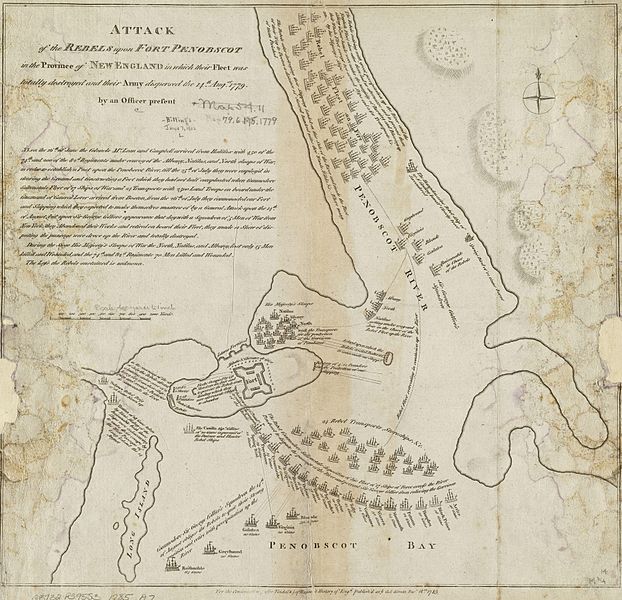
| 19:59, 9 January 2009 |  | 927 × 1,024 (844 KB) | Magicpiano | {{Information |Description={{en|1=This is a 1785 map depicting the 1779 naval action of the en:Penobscot Expedition. The original map measures 36.0x38.0cm. The caption reads: Attack of the rebels upon Fort Penobscot in the province of New England in |
File usage
The following 3 pages use this file:
Global file usage
The following other wikis use this file:
- Usage on fr.wikipedia.org
- Usage on it.wikipedia.org
- Usage on ja.wikipedia.org
- Usage on ru.wikipedia.org


