
File:Poloniae desciptio 1592 Wenceslao Godreccio.png

Size of this preview: 795 × 600 pixels. Other resolutions: 318 × 240 pixels | 636 × 480 pixels | 1,018 × 768 pixels | 1,280 × 966 pixels | 2,560 × 1,932 pixels | 3,750 × 2,830 pixels.
Original file (3,750 × 2,830 pixels, file size: 28.58 MB, MIME type: image/png)
| This is a file from the Wikimedia Commons. Information from its description page there is shown below. Commons is a freely licensed media file repository. You can help. |
Summary
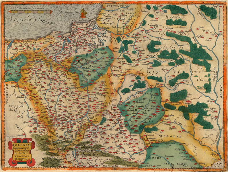
| Description | Map of Poland, researched and probably drawn by Wenceslaus Godreccius, printed by Abraham Ortelius in his Theatrum Orbis Terrarum in 1592 (first edited perhaps in 1578). An interesting feature are Polish names even outside the Polish Commonwealth, especially in Silesia. |
| Date | 1592, upload 2014-12-24 |
| Source | THE MAP HOUSE OF LONDON |
| Author | Wenceslaus Godreccius (cartographer), Abraham Ortelius (print editor), Ulamm (talk) 22:33, 24 December 2014 (UTC)(upload) |
Licensing
|
This work is in the public domain in its country of origin and other countries and areas where the copyright term is the author's life plus 100 years or fewer. | |
| This file has been identified as being free of known restrictions under copyright law, including all related and neighboring rights. | |
File history
Click on a date/time to view the file as it appeared at that time.
| Date/Time | Thumbnail | Dimensions | User | Comment | |
|---|---|---|---|---|---|
| current | 22:33, 24 December 2014 | | 3,750 × 2,830 (28.58 MB) | Ulamm | {{Information |Description=Map of Poland, researched and perhaps drawn by Wenceslaus Godreccius, printed by Abraham Ortelius in his Theatrum Orbis Terrarum in 1592 (first edited perhaps in 1578) |Source=http://www.themaphouse.com/Zoom.aspx?id=122059&re... |
File usage
The following pages on the English Wikipedia use this file (pages on other projects are not listed):
Global file usage
The following other wikis use this file:
- Usage on cs.wikipedia.org
- Usage on de.wikipedia.org
- Usage on hu.wikipedia.org
- Usage on lb.wikipedia.org
- Usage on pl.wikipedia.org
- Usage on uk.wikipedia.org