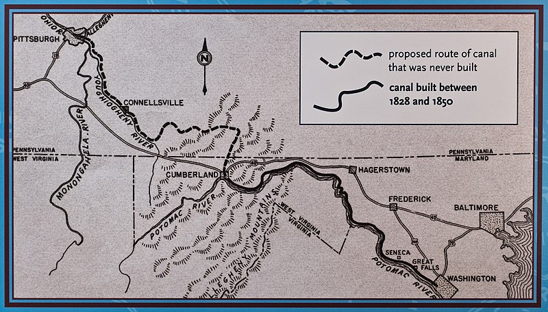
File:Proposed Map of C and O Canal.jpg
Appearance

Size of this preview: 800 × 456 pixels. Other resolutions: 320 × 182 pixels | 640 × 365 pixels | 1,024 × 584 pixels | 1,280 × 730 pixels | 2,560 × 1,459 pixels | 4,074 × 2,322 pixels.
Original file (4,074 × 2,322 pixels, file size: 5.91 MB, MIME type: image/jpeg)
File history
Click on a date/time to view the file as it appeared at that time.
| Date/Time | Thumbnail | Dimensions | User | Comment | |
|---|---|---|---|---|---|
| current | 23:21, 6 May 2013 |  | 4,074 × 2,322 (5.91 MB) | Bonnachoven | Close up and crop of the proposed map. |
| 23:15, 6 May 2013 |  | 3,144 × 4,212 (6.93 MB) | Bonnachoven | {{Information |Description ={{en|1=Proposed Map of Chesapeake and Ohio Canal, including portions never built. }} |Source =United States Dept. of Interior. National Park Service information sign in Great Falls Tavern, Great Falls, MD, on the... |
File usage
The following 4 pages use this file:
Global file usage
The following other wikis use this file:
- Usage on www.wikidata.org


