
File:Pyrénées-Atlantiques - Pau arrondissement 2017.svg

Size of this PNG preview of this SVG file: 800 × 494 pixels. Other resolutions: 320 × 198 pixels | 640 × 396 pixels | 1,024 × 633 pixels | 1,280 × 791 pixels | 2,560 × 1,582 pixels | 1,000 × 618 pixels.
Original file (SVG file, nominally 1,000 × 618 pixels, file size: 2.12 MB)
| This is a file from the Wikimedia Commons. Information from its description page there is shown below. Commons is a freely licensed media file repository. You can help. |
Summary
| Description |
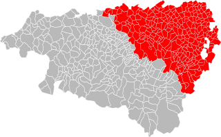
English: Map of the arrondissement Pau of the département Pyrénées-Atlantiques within the region Nouvelle-Aquitaine in France |
| Date | |
| Source | Blank Map of Pyrénées-Atlantiques Department, France, with Communes.svg |
| Author | Poulpy |
Licensing
This file is licensed under the Creative Commons Attribution-Share Alike 3.0 Unported license.
- You are free:
- to share – to copy, distribute and transmit the work
- to remix – to adapt the work
- Under the following conditions:
- attribution – You must give appropriate credit, provide a link to the license, and indicate if changes were made. You may do so in any reasonable manner, but not in any way that suggests the licensor endorses you or your use.
- share alike – If you remix, transform, or build upon the material, you must distribute your contributions under the same or compatible license as the original.
File history
Click on a date/time to view the file as it appeared at that time.
| Date/Time | Thumbnail | Dimensions | User | Comment | |
|---|---|---|---|---|---|
| current | 09:32, 18 July 2017 | | 1,000 × 618 (2.12 MB) | Giovanni-PSV | User created page with UploadWizard |
File usage
No pages on the English Wikipedia use this file (pages on other projects are not listed).
Global file usage
The following other wikis use this file:
- Usage on fa.wikipedia.org
- Usage on fr.wikipedia.org
- Usage on oc.wikipedia.org