File:RS101 Christchurch.jpg
Appearance

Size of this preview: 619 × 599 pixels. Other resolutions: 248 × 240 pixels | 496 × 480 pixels | 793 × 768 pixels | 1,058 × 1,024 pixels | 2,116 × 2,048 pixels | 6,021 × 5,828 pixels.
Original file (6,021 × 5,828 pixels, file size: 9.92 MB, MIME type: image/jpeg)
File history
Click on a date/time to view the file as it appeared at that time.
| Date/Time | Thumbnail | Dimensions | User | Comment | |
|---|---|---|---|---|---|
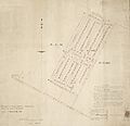
| current | 22:44, 13 September 2012 |  | 6,021 × 5,828 (9.92 MB) | Schwede66 | {{Information |Description ={{en|1=Part of rural section no 101. Survey map with cadastral information for a subdivision of 125 residential lots and new roads, one block north of Ferry Road, Christchurch. New roads bounding the subdivision are named... |
File usage
The following page uses this file:

