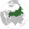
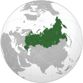
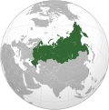
File:Russian Federation (orthographic projection) - disputed territories.svg
Appearance

Size of this PNG preview of this SVG file: 541 × 541 pixels. Other resolutions: 240 × 240 pixels | 480 × 480 pixels | 768 × 768 pixels | 1,024 × 1,024 pixels | 2,048 × 2,048 pixels.
Original file (SVG file, nominally 541 × 541 pixels, file size: 531 KB)
File history
Click on a date/time to view the file as it appeared at that time.
| Date/Time | Thumbnail | Dimensions | User | Comment | |
|---|---|---|---|---|---|
| current | 19:21, 18 May 2014 |  | 541 × 541 (531 KB) | Denniss | Reverted to version as of 15:09, 28 April 2014 |
| 15:21, 18 May 2014 |  | 541 × 541 (528 KB) | DeJaDenis | нормально Крым отображается, а не та размазня | |
| 15:09, 28 April 2014 |  | 541 × 541 (531 KB) | Denniss | Reverted to version as of 22:28, 22 March 2014 | |
| 15:00, 28 April 2014 |  | 541 × 541 (528 KB) | Алексей 5 007 | Вернулся к версии, по состоянию на 19:41, 25 апреля 2014 г. | |
| 20:56, 25 April 2014 |  | 541 × 541 (531 KB) | Denniss | Reverted to version as of 09:21, 24 March 2014 | |
| 19:41, 25 April 2014 |  | 541 × 541 (528 KB) | Jimmy Slade | Reverted to version as of 07:11, 24 March 2014 | |
| 09:21, 24 March 2014 |  | 541 × 541 (531 KB) | Denniss | Reverted to version as of 22:28, 22 March 2014 | |
| 07:11, 24 March 2014 |  | 541 × 541 (528 KB) | Георгий Вовк | Reverted to version as of 01:08, 23 March 2014 | |
| 09:26, 23 March 2014 |  | 541 × 541 (531 KB) | Seryo93 | Reverted. Please retain highlightning (at least for Crimea) | |
| 01:08, 23 March 2014 |  | 541 × 541 (528 KB) | Knyaz-1988 | New version |
File usage
The following page uses this file:
Global file usage
The following other wikis use this file:
- Usage on eo.wikipedia.org
- Usage on es.wikipedia.org
- Usage on incubator.wikimedia.org
- Usage on ru.wikimedia.org
- Usage on ru.wiktionary.org
- Usage on tyv.wikipedia.org


