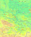
File:Sachsen-Anhalt.gif
Appearance

Size of this preview: 508 × 600 pixels. Other resolutions: 203 × 240 pixels | 407 × 480 pixels | 650 × 768 pixels | 1,163 × 1,373 pixels.
Original file (1,163 × 1,373 pixels, file size: 512 KB, MIME type: image/gif)
File history
Click on a date/time to view the file as it appeared at that time.
| Date/Time | Thumbnail | Dimensions | User | Comment | |
|---|---|---|---|---|---|
| current | 19:39, 14 October 2013 |  | 1,163 × 1,373 (512 KB) | Ulamm | Corrected names: Colbitz-Letzlinger Heide and Hakel |
| 21:57, 30 March 2012 |  | 1,163 × 1,373 (512 KB) | Ulamm | corrected name: "Hohe Schnecke" to "Hohe Schrecke" | |
| 19:47, 3 October 2008 |  | 1,163 × 1,373 (512 KB) | Ulamm | {{Information |Description= |Source= |Date= |Author= |Permission= |other_versions= }} | |
| 01:18, 16 March 2008 |  | 1,163 × 1,373 (512 KB) | Ulamm | ||
| 11:29, 22 February 2008 |  | 1,163 × 1,373 (512 KB) | Ulamm | ||
| 11:36, 21 February 2008 |  | 1,163 × 1,373 (510 KB) | Ulamm | ||
| 22:51, 19 February 2008 |  | 1,163 × 1,373 (508 KB) | Ulamm | {{Information |Description= |Source= |Date= |Author= |Permission= |other_versions= }} | |
| 16:02, 19 February 2008 |  | 1,163 × 1,373 (507 KB) | Ulamm | ||
| 15:49, 19 February 2008 |  | 1,163 × 1,373 (508 KB) | Ulamm | {{Information |Description=Physical map of Sachsen-Anhalt |Source=http:IIwww.maps-for-free.com |Date= |Author=~~~~ |Permission= |other_versions= }} Category:Maps of Germany Category:Sachsen-Anhalt |
File usage
No pages on the English Wikipedia use this file (pages on other projects are not listed).
Global file usage
The following other wikis use this file:
- Usage on af.wikipedia.org
- Usage on als.wikipedia.org
- Usage on da.wikipedia.org
- Usage on de.wikipedia.org
- Usage on diq.wikipedia.org
- Usage on dsb.wikipedia.org
- Usage on fo.wikipedia.org
- Usage on hr.wikipedia.org
- Usage on nds.wikipedia.org
- Usage on sl.wikipedia.org
