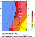
File:Seismic Hazard Map 2010 Pichilemu Earthquake.jpg
Appearance
Seismic_Hazard_Map_2010_Pichilemu_Earthquake.jpg (494 × 527 pixels, file size: 67 KB, MIME type: image/jpeg)
File history
Click on a date/time to view the file as it appeared at that time.
| Date/Time | Thumbnail | Dimensions | User | Comment | |
|---|---|---|---|---|---|
| current | 01:23, 6 September 2010 |  | 494 × 527 (67 KB) | Vanished user 24kwjf10h32h | {{Information |Description={{en|1=Seismic hazard map of 2010 Pichilemu earthquake.}} |Source=http://neic.usgs.gov/neis/eq_depot/2010/eq_100311_tsa6/neic_tsa6_w.jpg |Author=USGS |Date=2010-03-11 |Permission= |other_versions= |
File usage
The following page uses this file:
Global file usage
The following other wikis use this file:
- Usage on fr.wikipedia.org


