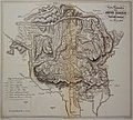
File:SetteComuni1850.jpg
Appearance

Size of this preview: 666 × 600 pixels. Other resolutions: 267 × 240 pixels | 533 × 480 pixels | 853 × 768 pixels | 1,137 × 1,024 pixels | 2,000 × 1,801 pixels.
Original file (2,000 × 1,801 pixels, file size: 1.45 MB, MIME type: image/jpeg)
File history
Click on a date/time to view the file as it appeared at that time.
| Date/Time | Thumbnail | Dimensions | User | Comment | |
|---|---|---|---|---|---|
| current | 16:28, 25 January 2014 |  | 2,000 × 1,801 (1.45 MB) | Nordavind | {{Informazioni file |Descrizione = Carta topografica dei Sette Comuni nel 1850 |Fonte = Patrizio Rigoni e Mauro Varotto, L'Altopiano dei Sette Comuni, Cierre ed., Sommacampagna (Vr), 2009 |Data = n.d. |Autore = n.d. |Licenza = |Detentore copyright = PU... |
File usage
The following page uses this file:
Global file usage
The following other wikis use this file:
- Usage on it.wikipedia.org
- Usage on pt.wikipedia.org
