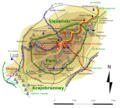
File:Sleza-mapa szczytu.png
Appearance

Size of this preview: 651 × 599 pixels. Other resolutions: 261 × 240 pixels | 521 × 480 pixels | 834 × 768 pixels | 1,112 × 1,024 pixels | 1,864 × 1,716 pixels.
Original file (1,864 × 1,716 pixels, file size: 1,016 KB, MIME type: image/png)
File history
Click on a date/time to view the file as it appeared at that time.
| Date/Time | Thumbnail | Dimensions | User | Comment | |
|---|---|---|---|---|---|
| current | 09:10, 16 January 2010 |  | 1,864 × 1,716 (1,016 KB) | Kicior99 | Zmiana formatu napisu - letter art; small changes |
| 13:54, 14 January 2010 |  | 1,844 × 1,684 (1,013 KB) | Kicior99 | correction | |
| 06:43, 14 January 2010 |  | 1,916 × 1,732 (1,015 KB) | Kicior99 | zlikwidowano rozmycie (blur ereased) | |
| 14:09, 12 January 2010 |  | 1,840 × 1,752 (1.75 MB) | Kicior99 | Adding scale / Addition de l'echelle | |
| 03:56, 12 January 2010 |  | 1,852 × 1,576 (1.74 MB) | Kicior99 | petty cosmetic changes | |
| 00:34, 12 January 2010 |  | 1,872 × 1,540 (1.74 MB) | Kicior99 | final cut | |
| 21:10, 11 January 2010 |  | 1,840 × 1,560 (1.73 MB) | Kicior99 | ancient ridges | |
| 14:08, 11 January 2010 |  | 1,796 × 1,576 (1.72 MB) | Kicior99 | revamp, compact look | |
| 13:28, 11 January 2010 |  | 1,824 × 1,604 (1.72 MB) | Kicior99 | many essential changes: letters, trails, layers | |
| 12:36, 11 January 2010 |  | 1,824 × 1,572 (959 KB) | Kicior99 | archeological trails |
File usage
The following page uses this file:
Global file usage
The following other wikis use this file:
- Usage on cs.wikipedia.org
- Usage on eo.wikipedia.org
- Usage on pl.wikipedia.org
- Ślęża
- Wikipedia:Ilustracje na Medal/rysunki i animacje
- Wikipedia:Propozycje do Ilustracji na Medal/Sleza-mapa szczytu.png
- Wikipedysta:Kicior99/atlas
- Szablon:Ilustracja na medal/2011-09-27
- Szablon:Ilustracja na medal/2013-05-15
- Szablon:Ilustracja na medal/2014-06-06
- Wikipedysta:The Polish/Nieużywane szablony/Ilustracja na medal/1-500
- Wikipedysta:The Polish/Nieużywane szablony/Ilustracja na medal/501-1000
- Wikipedysta:The Polish/Nieużywane szablony/Ilustracja na medal/1001-1500


