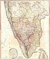
File:South India Map 1794.jpg
Appearance

Size of this preview: 442 × 599 pixels. Other resolutions: 177 × 240 pixels | 354 × 480 pixels | 567 × 768 pixels | 755 × 1,024 pixels | 1,511 × 2,048 pixels | 3,400 × 4,608 pixels.
Original file (3,400 × 4,608 pixels, file size: 2.59 MB, MIME type: image/jpeg)
File history
Click on a date/time to view the file as it appeared at that time.
| Date/Time | Thumbnail | Dimensions | User | Comment | |
|---|---|---|---|---|---|
| current | 16:57, 10 August 2007 |  | 3,400 × 4,608 (2.59 MB) | Marcus334 | {{Information |Description= A New and Accurate Map of the Southern Provinces of Hindoostan, shewing The Territories ceded by TIPOO SAHIB to the Different Powers |Source= Published by R. Wilkinson, 58 Cornhill, London |Date= Jan 1, 1794 |Author= T. Foot Sc |
File usage
The following 2 pages use this file:
Global file usage
The following other wikis use this file:
- Usage on ar.wikipedia.org
- Usage on ca.wikipedia.org
- Usage on ta.wikipedia.org
- Usage on vi.wikipedia.org

