
File:Sugarland-mtn-trail-rough-crk-valley1.jpg
Size of this preview: 800 × 600 pixels. Other resolutions: 320 × 240 pixels | 640 × 480 pixels | 1,024 × 768 pixels | 1,280 × 960 pixels | 2,048 × 1,536 pixels.
Original file (2,048 × 1,536 pixels, file size: 915 KB, MIME type: image/jpeg)
| This is a file from the Wikimedia Commons. Information from its description page there is shown below. Commons is a freely licensed media file repository. You can help. |
Summary
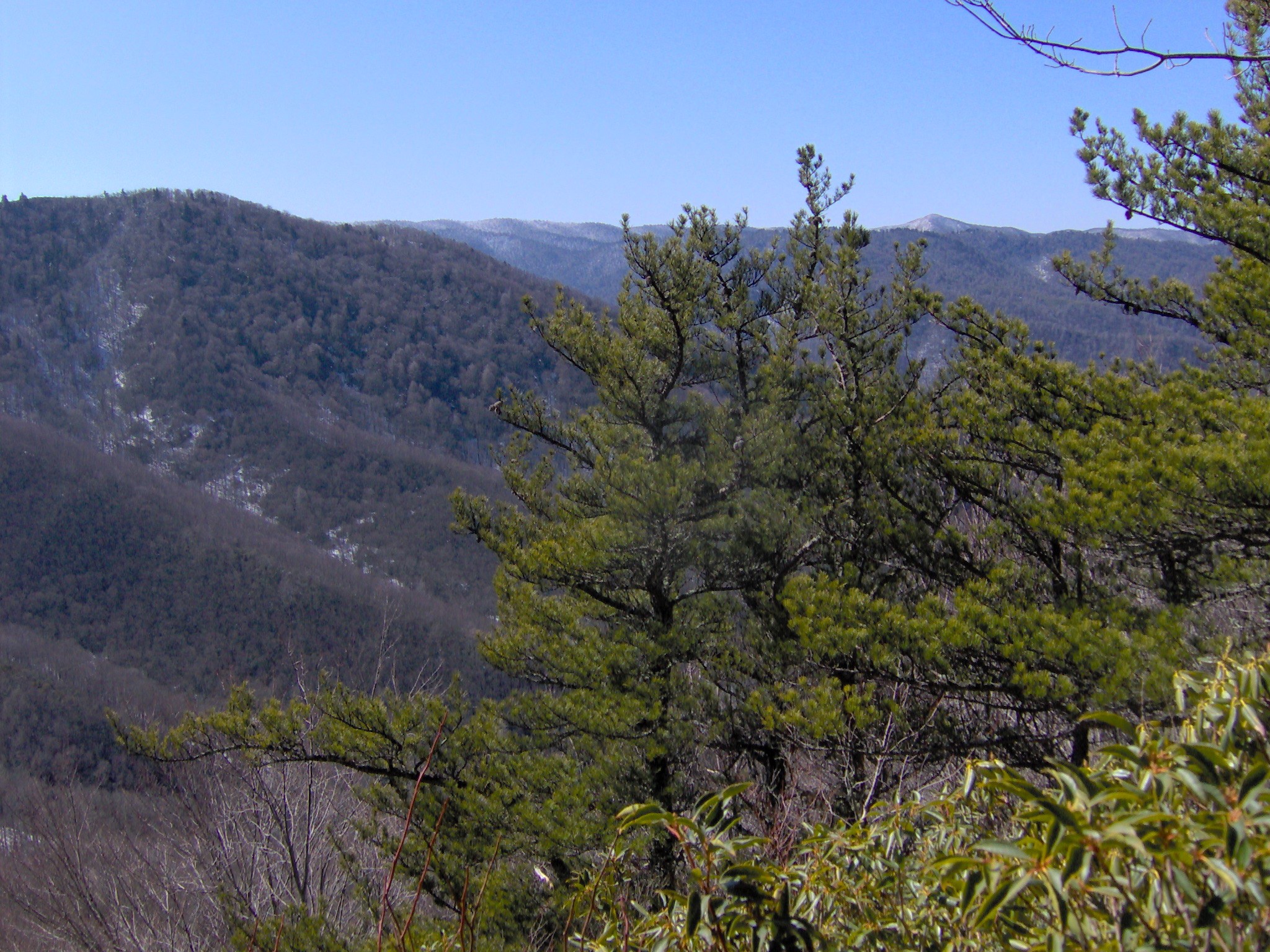
| Description | Looking out over the Rough Creek Valley from a break in the foliage, appx. 8 miles from the trailhead at Fighting Creek Gap. Sweet Ridge is on the left, and Miry Ridge and main crest of the Smokies are in the distance. The snow-capped summit of Silers Bald is in the distance on the right. Trees are Pinus pungens. Author Horace Kephart termed this area "Godforsaken" due to its remoteness. |
| Date | |
| Source | Own work |
| Author | Brian Stansberry |
Licensing
I, the copyright holder of this work, hereby publish it under the following licenses:

|
Permission is granted to copy, distribute and/or modify this document under the terms of the GNU Free Documentation License, Version 1.2 or any later version published by the Free Software Foundation; with no Invariant Sections, no Front-Cover Texts, and no Back-Cover Texts. A copy of the license is included in the section entitled GNU Free Documentation License. |
This file is licensed under the Creative Commons Attribution 3.0 Unported license.
- You are free:
- to share – to copy, distribute and transmit the work
- to remix – to adapt the work
- Under the following conditions:
- attribution – You must give appropriate credit, provide a link to the license, and indicate if changes were made. You may do so in any reasonable manner, but not in any way that suggests the licensor endorses you or your use.
You may select the license of your choice.
File history
Click on a date/time to view the file as it appeared at that time.
| Date/Time | Thumbnail | Dimensions | User | Comment | |
|---|---|---|---|---|---|
| current | 22:29, 4 March 2008 | | 2,048 × 1,536 (915 KB) | BrineStans | {{Information |Description=Looking out over the Rough Creek Valley from a break in the foliage, appx. 8 miles from the trailhead at Fighting Creek Gap. Sweet Ridge is on the left, and Miry Ridge and main crest of the Smokies are in the distance. The sno |
File usage
The following pages on the English Wikipedia use this file (pages on other projects are not listed):